0325L-MONDAY OUTLOOK FROM GARFIELD COUNTY EMERGENCY MANAGEMENT-8/15/22
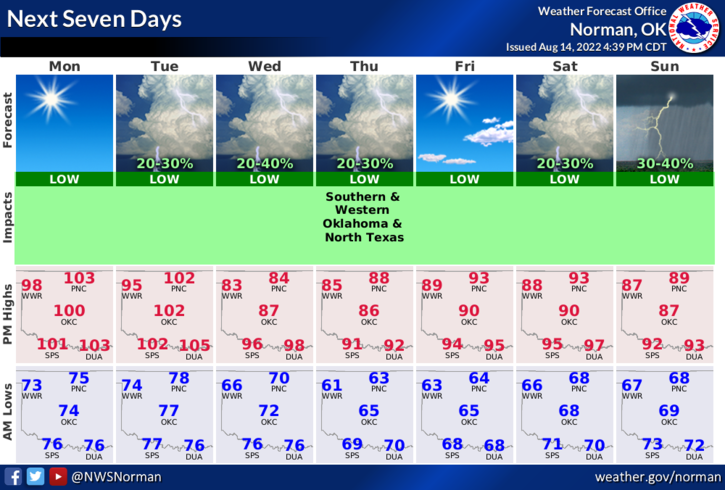
1- Another hot day with highs in the low 100s. The cold front that everyone is waiting for should push through the area around mid-day on Tuesday. It could be morning or afternoon. I went with the medium timeframe. Temps will definitely cool down compared to what we have dealt with all summer. High temps starting Wednesday will be in the low to mid 80s and overnight lows in the mid to upper 60s.
2- Here is your forecast from the NWS/NORMAN;
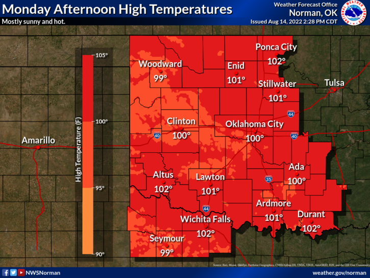
Today-Sunny, hot with highs around 101. South winds 10 to 15 mph gusting to 20 mph.
Tonight-Mostly clear. Lows in the mid-70s. South winds 10 to 15 mph gusting to 20 mph.
3-We are still in a severe drought situation so if you see smoke or fire, call 911 so the proper response can be sent. Also, keep that eye out for suspicious activity and call law enforcement if you see any. Overall, we’ll be ok. Hopefully we’ll see some rain but that is looking bleak right now. We’ll see what happens.
HAVE A GOOD DAY! Be sure to download our GARFIELD COUNTY EM app.