0355L-MONDAY OUTLOOK FROM GARFIELD COUNTY EMERGENCY MANAGEMENT-12/14/20
A WINTER WEATHER ADVISORY HAS BEEN ISSUED FOR TUESDAY FROM 6AM UNTIL 6PM
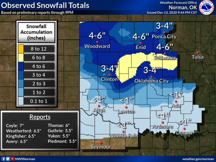
1- We weathered through the first wave and a second wave should arrive sometime Tuesday morning. Officially, 5 inches of snow fell but there may have been a few areas where higher amounts occurred. That said, heavier traveled roads are mostly clear BUT, there may be areas where black ice could become an issue. Slow down and drive carefully. Some rural roads may be a bit treacherous so be especially careful out there.
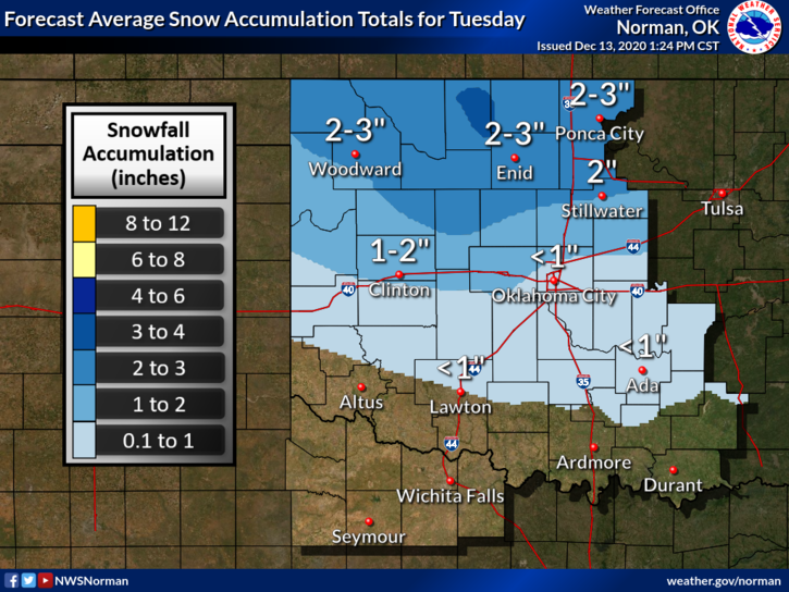
2- Round two -Snow will occur tomorrow morning and we could see upwards of an additional 2 to 3 inches of snow. This may change so we’ll see how guidance changes throughout the day. Graphics will change too so stay up with the latest info and make sure you have our GARFIELD COUNTY EM app.
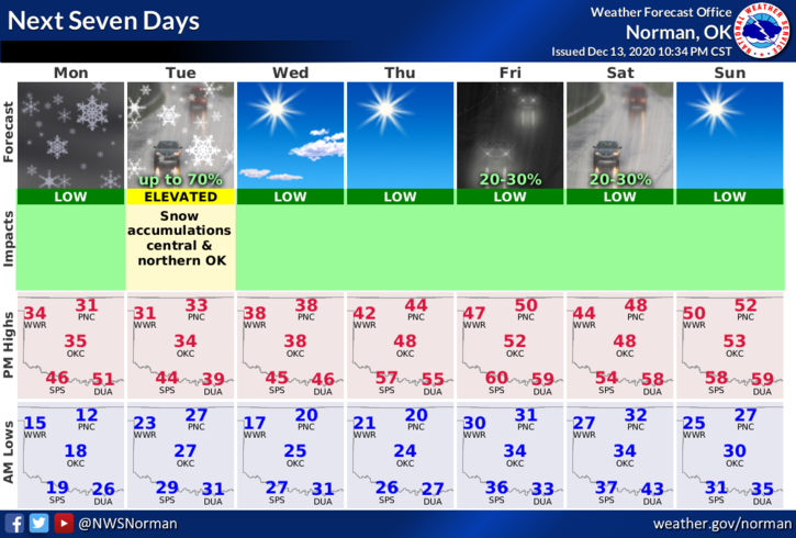
3- Overall, enjoy the winter weather and we’ll be ok. Here is your forecast from the NWS/NORMAN;
Monday-Partly cloudy. Highs in the lower 30s. Light and variable winds becoming southeast around 10 mph in the afternoon.
Monday Night- Mostly cloudy. Lows in the lower 20s. Southeast winds around 10 mph.
HAVE A GOOD DAY!
MIKE