0355L-SUNDAY OUTLOOK FROM GARFIELD COUNTY EMERGENCY MANAGEMENT-12/13/20
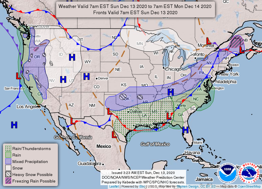
1- WINTER STORM WARNING IN EFFECT UNTIL 6PM THIS EVENING. We are in a good position to receive snow today if the storm track stays true to guidance. Right now, as of 0330 we are at 34 degrees and the storm system is still out west. We’ll see what happens through the morning hours.
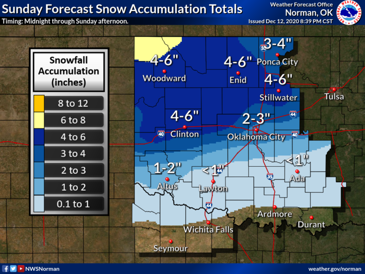
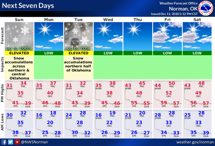
2- Winds will be from the north at around 20 mph today so that will keep wind chill temps low. If you are outside make sure you cover your skin. We still are expecting 1-3 inches of snow but where enhanced precipitation falls you may see heavier amounts. For now, we are in the waiting mode so we’ll see what happens. Just FYI, another storm system will blast through here on Tuesday bringing us a chance for snow once again.
3- Here is your forecast from the NWS/NORMAN;
Sunday-Snow before 3pm. High near 32. Northeast wind 10 to 15 mph becoming north northwest in the afternoon. Winds could gust as high as 21 mph. Chance of precipitation is 100%. New snow accumulation of 3 to 5 inches possible.
Sunday Night-Mostly clear, with a low around 17. West northwest wind 5 to 10 mph.
HAVE A GOOD DAY!
MIKE