0410L-TUESDAY OUTLOOK FROM GARFIELD COUNTY EMERGENCY MANAGEMENT-12/15/20
WINTER WEATHER ADVISORY IN EFFECT FROM 6AM UNTIL 9PM TONIGHT.
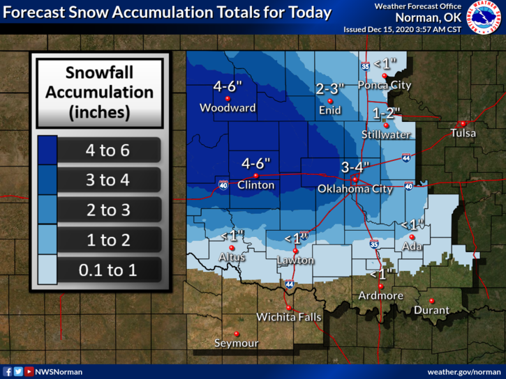
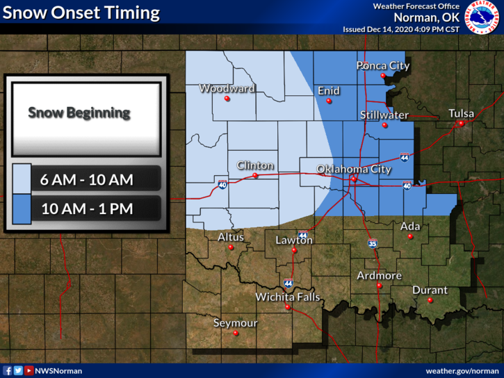
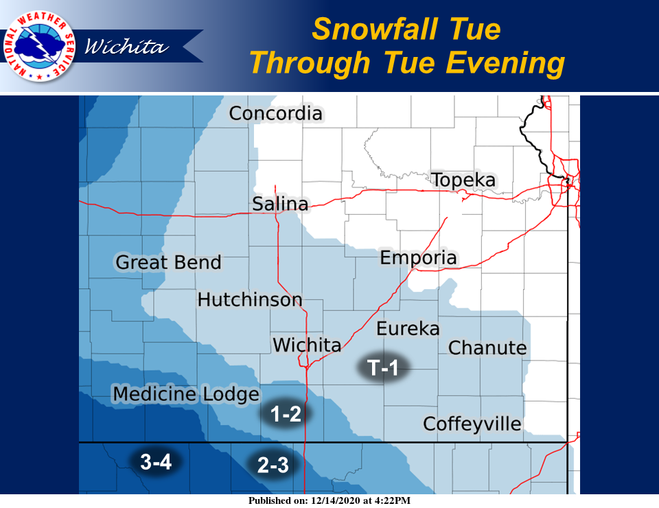
1- The storm track has shifted a little to the SSW and we’ll see another day similar to Sunday but the heavier snowfall should remain west and southwest of Garfield County. We are still forecast to receive 2-3 inches but if the track shifts one way or the other we may see more or less. The graphics attached will change several times today so keep this in mind. I am also attaching graphics from the Wichita NWS office.
2- Overall, we’ll be ok but keep a few things in mind; Pay attention to your driving without looking at your phones, especially those who have kids in the car. Take the time to STOP at red lights and STOP signs. Rolling through them may get you a ticket or worse, into an accident. I really don’t want either to occur. For some reason we even have folks speeding through School Zones. The folks I have observed doing this are engrossed in their phones. I would like to think folks have better sense than this. As an Emergency Manager, I am trying to prevent YOUR EMERGENCY.
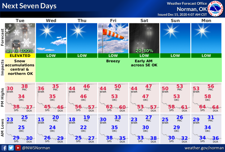
3- Here is your forecast from the NWS/NORMAN;
Today- 100% chance for Snow, mainly after 9am. High near 32. East wind around 10 mph becoming north northeast in the afternoon. Total daytime snow accumulation of 2 to 3 inches possible.
Tonight-40 percent chance of snow before midnight with a low around 22. North northeast wind around 10 mph becoming northwest after midnight. New snow accumulation of less than a half inch possible.
Finally, you can get ROAD CONDITIONS on the FRONT PAGE of our gcem.org website and be sure to download our notification app-GARFIELD COUNTY EM.
HAVE A GOOD DAY!
MIKE