0305L-TODAY’S OUTLOOK FROM GARFIELD COUNTY EMERGENCY MANAGEMENT-2/7/22
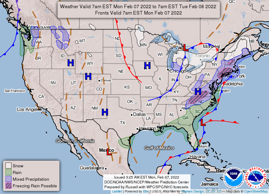
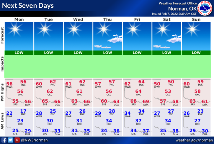
1- We will continue the warming trend today and this week. The only exceptions will be a couple of fronts that will cool us down a little. NO precipitation is expected with either front right now. The only noticeable difference in the sky will be high clouds per guidance.
2- The front this weekend is expected to be dry right now but we might see temps drop into the 30 or 40s for highs. We’ll have to wait and see what happens for sure. Our low temps will average in the upper 20s to low 30s. Not too bad for this time of year.
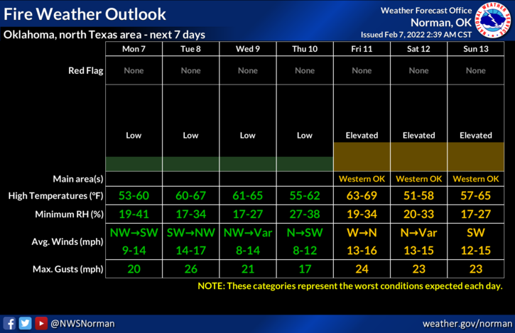
3- The FIRE DANGER will be marginal as foliage is still dead. Yes, we received some snow but that soaks in and some evaporates leaving the dead stuff on top. Those doing controlled burning just need to pay close attention and don’t let the fire get away from you. If it does, call 911.
4- Overall, we’ll be ok so get outside when you can and enjoy the day. Here is your forecast from the NWS/NORMAN;
Today-Sunny. Highs in the upper 50s. West winds 10 to 15 mph.
Tonight-Clear. Lows in the mid-20s. Southwest winds around 10 mph.
STAY SAFE!