0420L-MONDAY UPDATE FROM GARFIELD COUNTY EMERGENCY MANAGEMENT-1/15/18
Here comes another ARCTIC front so here are a few weather tips and info;
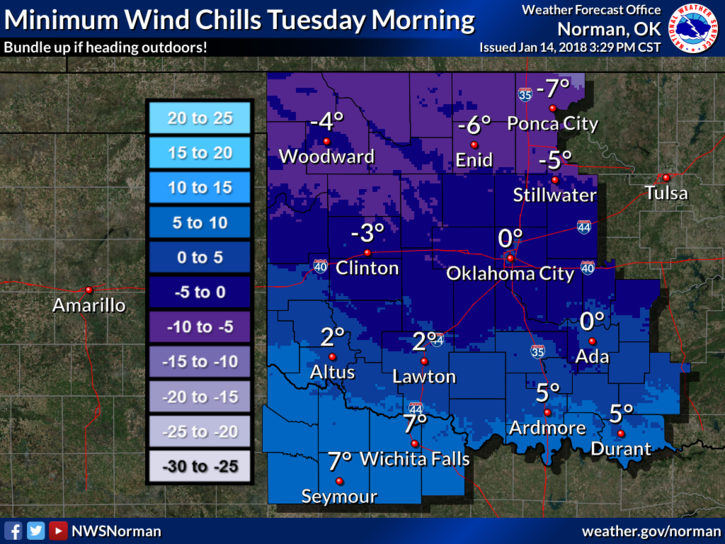
1-WIND CHILL ADVISORY IN EFFECT FROM MIDNIGHT MONDAY NIGHT UNTIL 10 AM TUESDAY MORNING. Wind chill temps from -5 to -12 degrees are possible. FROSTBITE could occur within 30 minutes if precautions aren’t taken. This is a dangerous situation for skin. Make sure outdoor animals are protected too.
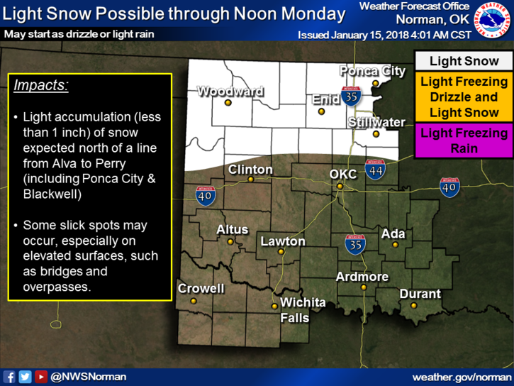
2-SLIGHT chance for frozen precip this morning as the front pushes through. Per NWS guidance, it appears that heavier precip MIGHT occur from a Medford to Perry line. Either way, when driving, watch out for slick spots on bridges and overpasses just in case.
3-Nothing dramatic out there other than we are actually having winter weather. Just take the proper precautions to protect your skin. Drive appropriately too.
4- The FIRE DANGER IS ELEVATED so report any smoke or fire to 911 so response can be enabled. These cold conditions are a nightmare for fire personnel and law enforcement so PLEASE be careful.
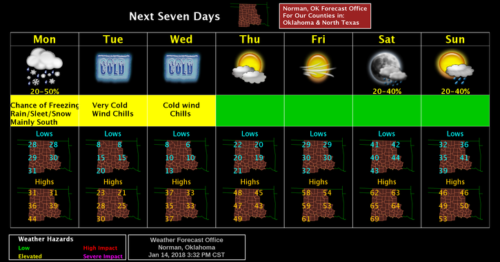
5-A warmup should kick in by mid-week and we should see 50’s and 60’s this coming weekend. I hope some rain comes with it!!
Here is your forecast from the NWS/NORMAN;
Monday-20% chance of drizzle, snow, and freezing drizzle before noon, then a slight chance of flurries between noon and 3pm. Cloudy, with temperatures falling to near 22 by 5pm. North winds 15 to 25 mph gusting to 35 mph.
Monday Night-Mostly cloudy then gradually becoming mostly clear with a low around 7. Wind chill values as low as -6. North winds 10 to 15 mph gusting to 20 mph.
STAY WARM AND SAFE!!
MIKE