0305L-MONDAY OUTLOOK FROM GARFIELD COUNTY EMERGENCY MANAGEMENT-01/23/23
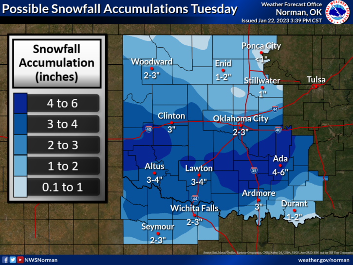
* Today looks pretty good with mostly sunny skies and light winds. Temps in the upper 40’s look good too. There is a change coming which gives us a chance for MAYBE 1-2 INCHES OF SNOW mainly Tuesday afternoon. The storm system out west will track through Texas and southeast Oklahoma as it appears right now so we are on the northern periphery of this event. Highs tomorrow are forecast to be in the upper 30’s so we’ll wait and see if a slight shift in this system occurs. Otherwise, we’ll see a COLD RAIN. Either way, we do need the precipitation.
* if it does snow, road conditions may be affected early but ground temps would support accumulation on grassy and elevated areas. Again, we’ll see how this tracks and where temps will be as we get closer to this event.
* Remember that we are in an EXTREME DROUGHT. If you see smoke or fire out there, call 911 so the proper response can be sent.
*Overall, we’ll be ok so here is your forecast from the NWS/NORMAN;
Today- Mostly sunny. Highs in the upper 40s. Northwest winds around 5 mph, becoming southwest around 5 mph this afternoon.
Tonight- Mostly cloudy. Cold with lows in the upper 20s. Southeast winds around 5 mph.
HAVE A GOOD DAY!