0355L-MONDAY OUTLOOK & INFO FROM GARFIELD COUNTY EMERGENCY MGMT-1/27/2020
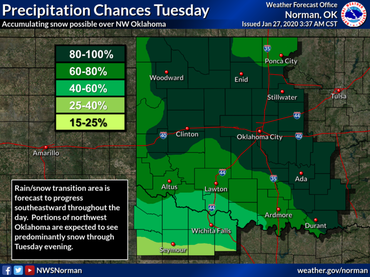
1- WINTER STORM WATCH IN EFFECT from late tonight through Tuesday afternoon. 3 to 6 inches of snow is possible in the watch area which is west, north, and northwest of us. GARFIELD COUNTY is NOT included in this watch yet, but we might be if the storm track wavers a little. If we end up in in the watch, it will come out over the GARFIELD COUNTY EM app.
2- Temps really won’t be in our favor later tonight but we will most likely see some rain. We’ll see what happens as this mess comes together. THERE IS NO “MILK and BREAD ALERTS” IN EFFECT FOR THIS STORM SYSTEM. By the way, if we do see a few inches of snow, just slow down and drive with caution. WE WILL SURVIVE!!
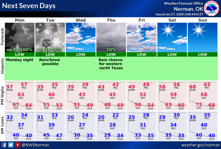
3- Here is your forecast from the NWS/NORMAN;
Monday-Mostly sunny with a high near 57. West wind 5 to 15 mph becoming east in the afternoon. Winds could gust as high as 20 mph.
Monday Night-Rain likely mainly after 3am. Cloudy with a low around 32. Northeast wind 15 to 20 mph, with gusts as high as 25 mph. Chance of precipitation is 60%. New precipitation amounts between a tenth and quarter of an inch possible.
FINALLY- We’ll be ok so enjoy the fairly warm weather today because our high tomorrow will be in the 30’s. Keep a coat and umbrella handy and stay warm.
HAVE A GREAT DAY!!
MIKE