0410L-TUESDAY OUTLOOK & INFO FROM GARFIELD COUNTY EMERGENCY MGMT-1/28/2020
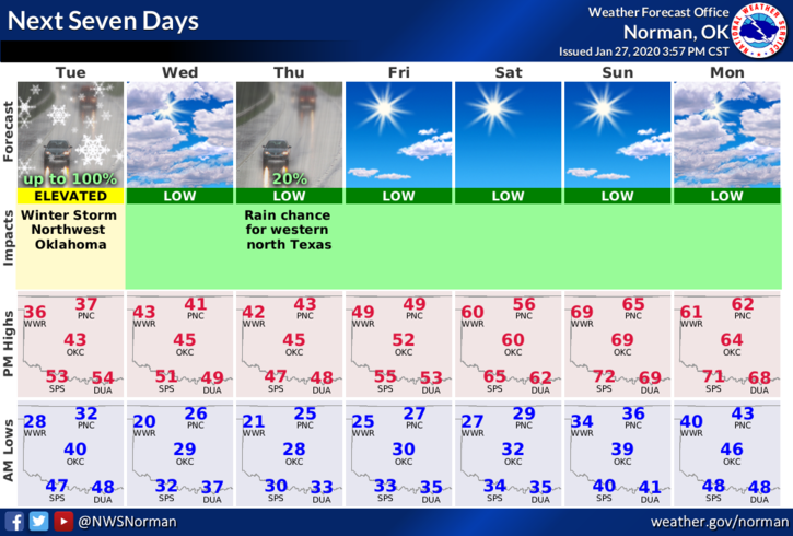
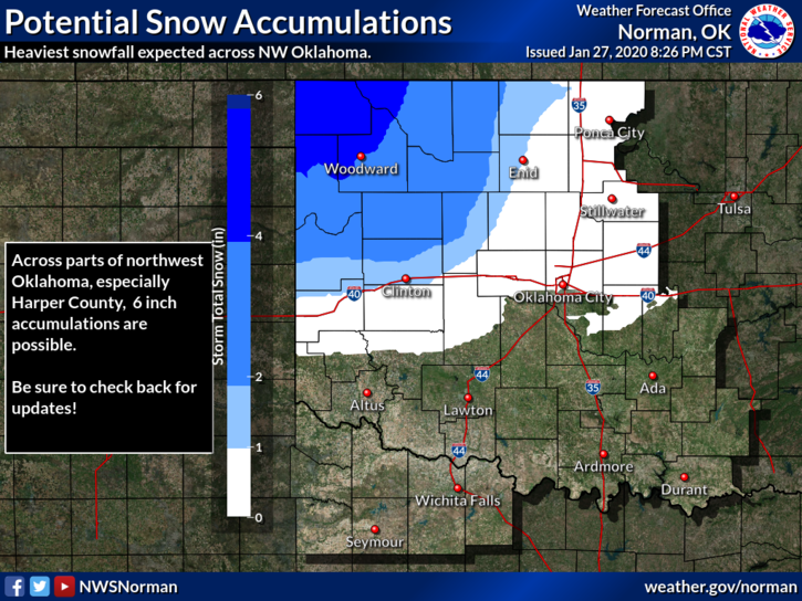
1- Winter Storm Warnings and Advisories are in effect out west. If you planned on traveling that way today, check in with whomever you were going to see and make a decision from there. As for Garfield County, we are just outside of an advisory area. Guidance still states we may see some snow later this morning and possibly this afternoon so we’ll keep an eye out and adjust accordingly.
2- Colder air is still forecast to filter into the area so as we get colder aloft (above us), we’ll see what happens. There is no need for panic or anything, the worst weather will occur out west and if we are lucky, we’ll see around 1-3 inches of snow by the end of today. Two THINGS TO KEEP IN MIND TODAY, TEMPS AND PRECIPITATION TYPE. If we get colder and it’s raining, bridges and overpasses could be affected due to icing. Just SLOW DOWN while driving if any precip is occurring.
3- Overall, we’ll be ok so here is your forecast from the NWS/NORMAN;
Today-Rain and isolated thunderstorms in the morning, then rain and snow in the afternoon. Much colder. Highs in the upper 30s. North winds 15 to 20 mph.
Tonight-A chance of snow and rain in the evening. Lows in the mid-20s. North winds 10 to 20 mph.
If anything major does change, make sure you have our GARFIELD COUNTY EM app. All NWS Advisories and Warnings automatically push through our app. The graphics attached were not updated by the NWS at the time of this post.
HAVE A GOOD DAY
MIKE