FROM THE OFFICE OF EMERGENCY MANAGEMENT ENID/GARFIELD COUNTY -7/3/17
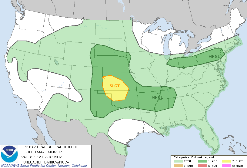
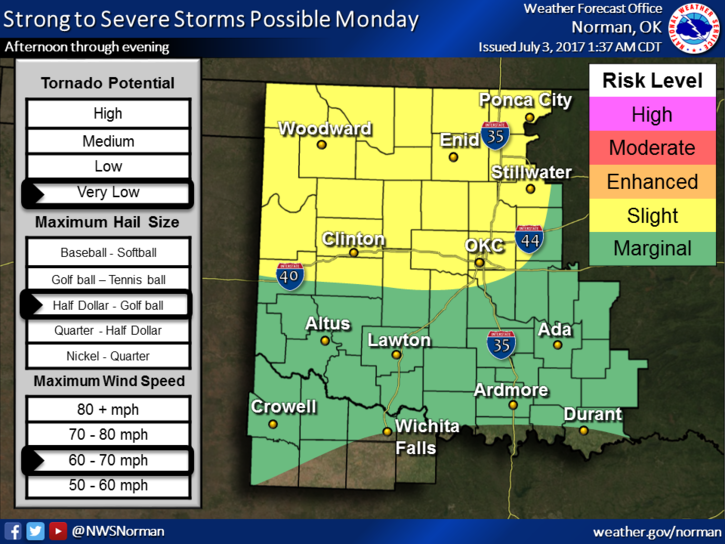
1-SLIGHT RISK for severe weather later today and tonight with wind and hail being the main threats. See graph.
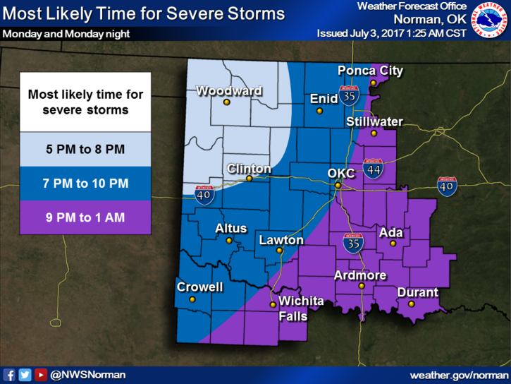
2-Rough timing- see graph
3-Rain potential is MARGINAL
It won’t rain everywhere all of the time but where it does rain, it may be torrential in nature.
Here is your forecast from the NWS/NORMAN;
Monday- 30% chance for t-storms after 1pm. Otherwise, partly sunny with highs around 92. HEAT INDEX near 98. Northeast winds 5-15 mph gusting to 25 mph becoming SE this afternoon.
Monday Night-Mostly cloudy with a low around 67. South winds 10 to 15 mph becoming north northwest in the evening. Winds could gust as high as 21 mph. Chance of precipitation is 60%. New rainfall amounts between a half and three quarters of an inch possible.
Download our free app-GARFIELD COUNTY EM. It could save your life!
HAVE A GREAT DAY!!
MIKE