0400L-MONDAY OUTLOOK FROM GARFIELD COUNTY EMERGENCY MANAGEMENT-6/17/19
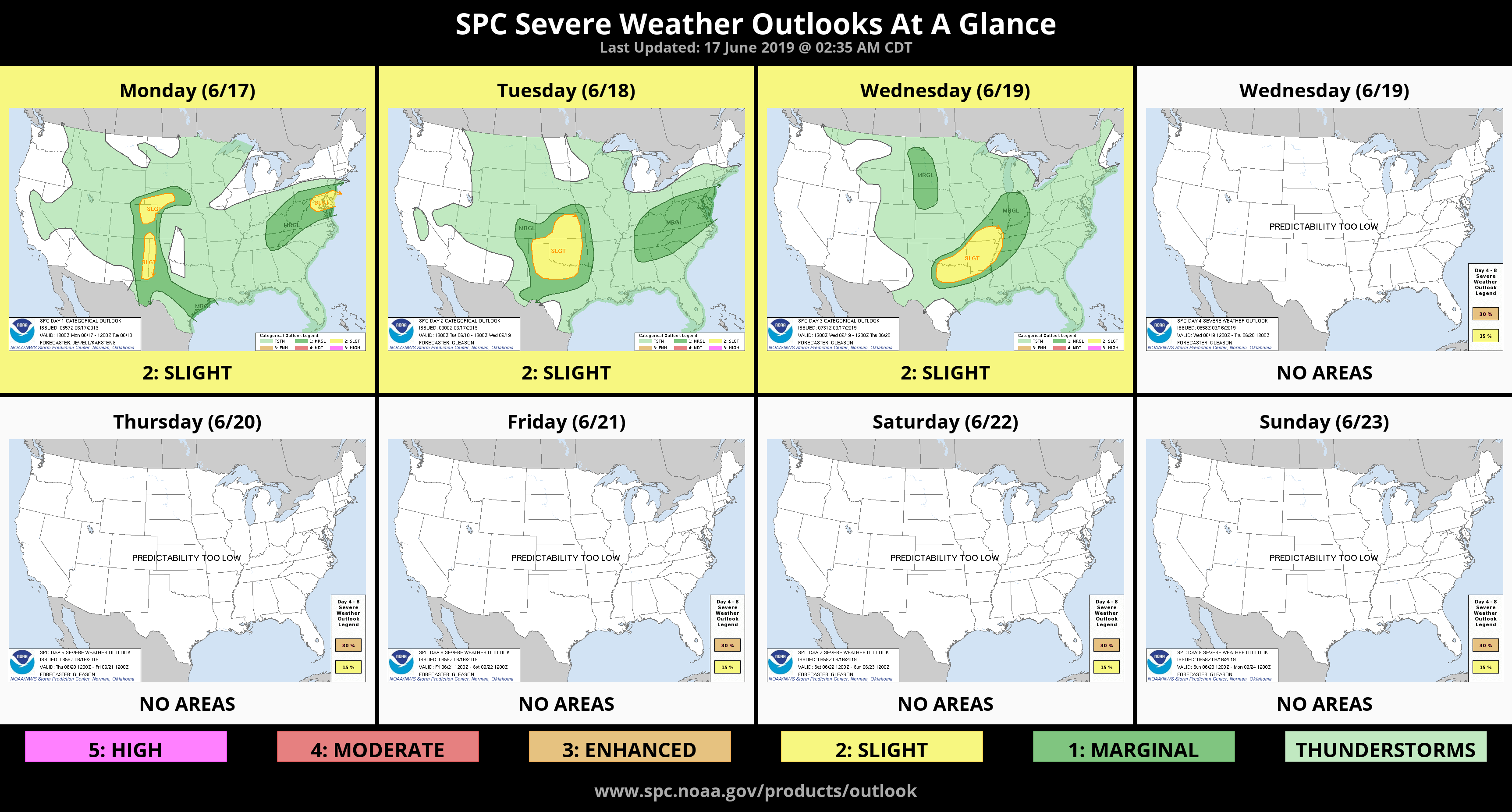
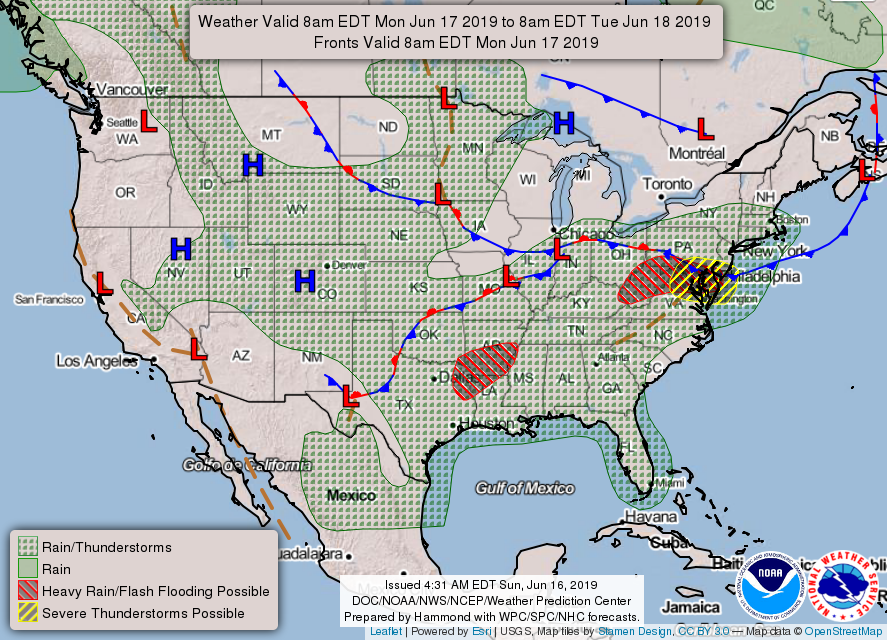
1- Thunderstorms will occur off and on all this week. There will be a few lulls during this timeframe but overall, if the sun shines get out and absorb some while you can. Tuesday afternoon and evening will be a severe weather possibility.
2- Be sure and download our GARFIELD COUNTY EM app. Your better prepared with it than without it.
3- When thunderstorms may or are approaching the area I usually send an app advisory out to let folks know what those possibilities are. I sometimes do this hours before anything develops. Those alerts time out as I can set the expiration time for those advisories. NWS info times out too. Just keep this in mind as we move forward in the process of trying to keep everyone informed. Read the information when it comes out and understand what we are discussing may occur later in the day or what is happening now AND THEN THAT INFO GOES AWAY. On social media, questions may be answered when time allows. Since social media venues set what’s relevant and what isn’t, I may not see your questions. We are working to solve this issue from our own website. Hopefully a solution occurs this year. I’ll advise if we find that solution.
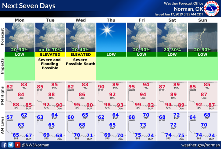
4- Here is your forecast from the NWS/NORMAN;
Monday- Partly cloudy. Highs in the mid 80s. Light and variable winds.
Monday Night- Partly cloudy. Lows in the mid 60s. Light and variable winds.
HAVE A GREAT DAY!!
MIKE