0355L-TUESDAY OUTLOOK FROM GARFIELD COUNTY EMERGENCY MANAGEMENT-6/18/19
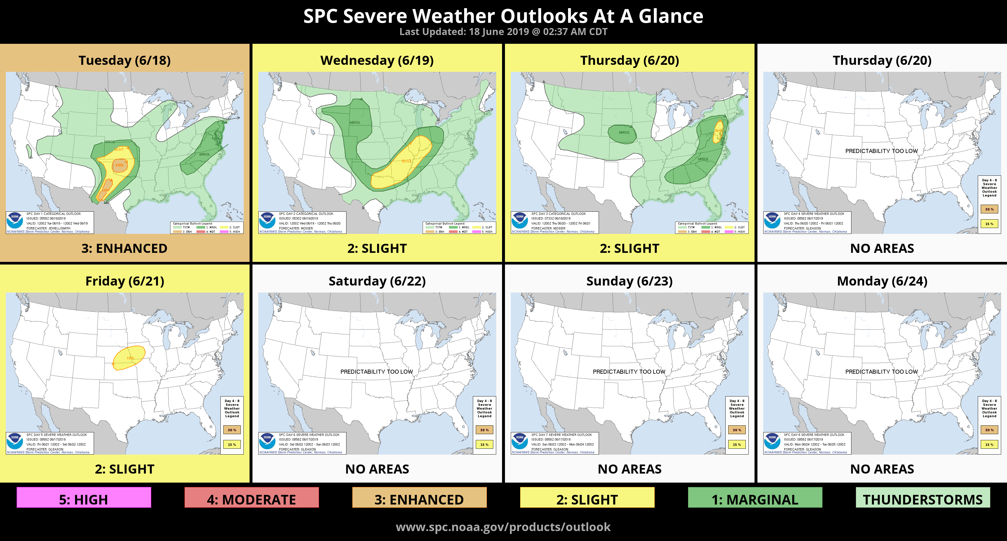
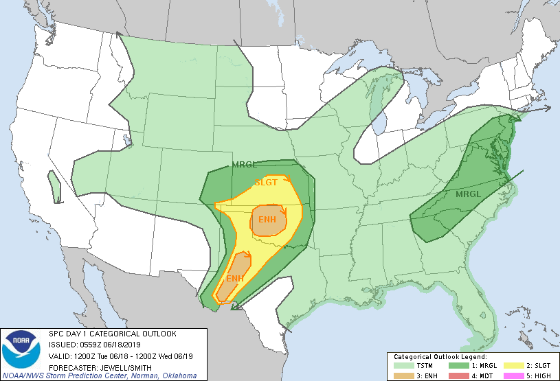
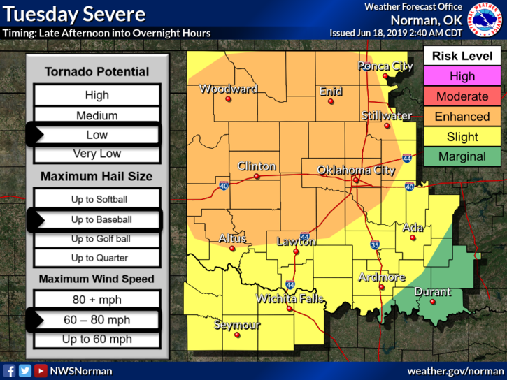
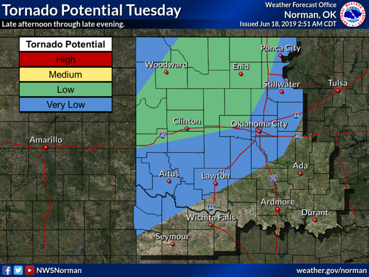
1- ENHANCED RISK FOR SEVERE WEATHER LATER TODAY. Until then, there is a possibility for some isolated showers. We have a cold front slowly moving our way from Kansas, a dryline in the Texas Panhandle and a strengthening low level jet this evening. These things combined will make for an interesting evening. Main threats are large hail, damaging winds, a low risk for tornadoes, intense lightning, and torrential rainfall. Spotters will be briefed and put on stand-by in the event they are needed. See graphics attached.
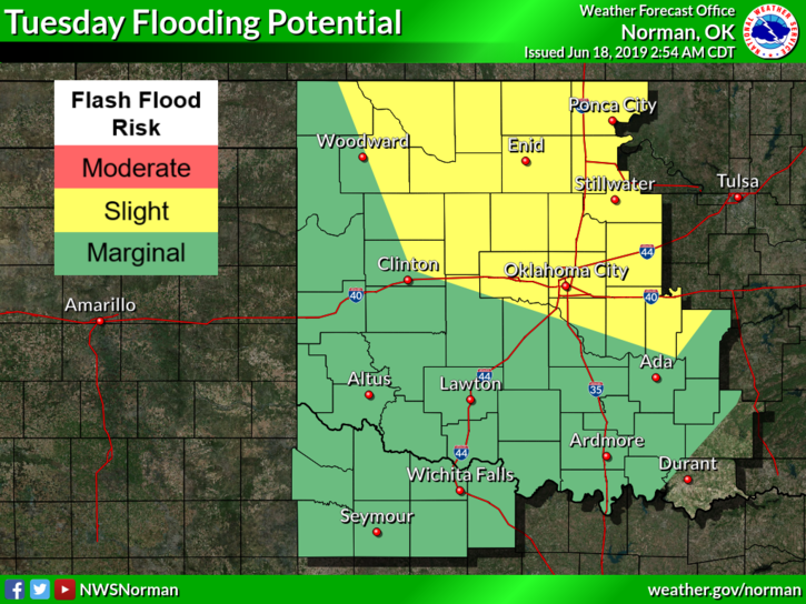
2- FLASH FLOODING may be possible if storms move slowly and train over the same areas. We’ll have to wait and see what happens for sure.
3- Make sure you have our GARFIELD COUNTY EM app so you can keep up with advisories from us and the NWS.
4- Here is your county-wide forecast from the NWS/NORMAN;
Today-Partly cloudy. A slight chance of t-storms this morning, then a chance of t-storms in the afternoon. Highs in the upper 80s. South winds around 10 mph in the afternoon. Chance of thunderstorms 30 percent.
Tonight-Mostly cloudy. A chance of t-storms in the evening, then t-storms likely after midnight. Lows in the mid-60s. South winds around 10 mph. Chance of thunderstorms 70 percent.
HAVE A GOOD DAY and we’ll advise as new info arrives.
MIKE