0330L-MONDAY OUTLOOK FROM GARFIELD COUNTY EMERGENCY MANAGEMENT-3/14/22
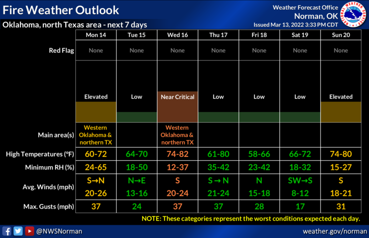
1- Not a lot of change from yesterday with the Fire Danger except the RED FLAG WARNING expired at 9pm last night. We don’t expect another one to be issued today. Winds will be strong from the south but will shift around from the north later as a cold front pushes in. Humidity will increase some helping to lessen the fire danger, but it will remain elevated. We don’t expect any rain with the front here in the region but the winds will continue to be a problem.
2- Overall, we’ll be ok but with strong winds quite a bit of dirt will be flying around out there. Here is your forecast from the NWS/NORMAN;
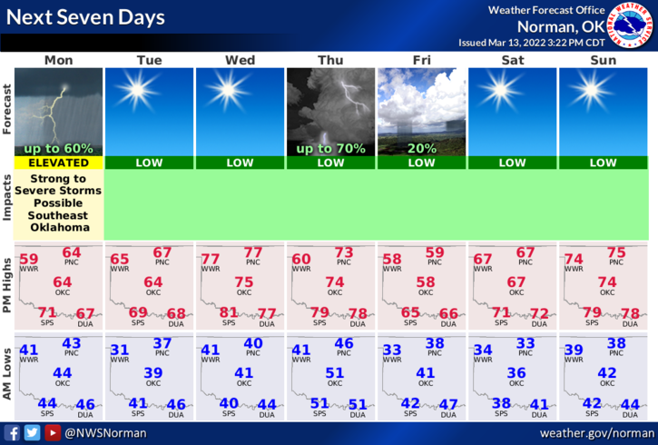
Today-Partly sunny this morning, then becoming mostly cloudy. Breezy with highs in the mid-60s. South winds 20 to 25 mph, becoming west 15 to 25 mph this afternoon.
Tonight-Mostly cloudy in the evening, then becoming partly cloudy. Lows in the mid-30s. North winds 15 to 20 mph with gusts up to 30 mph.
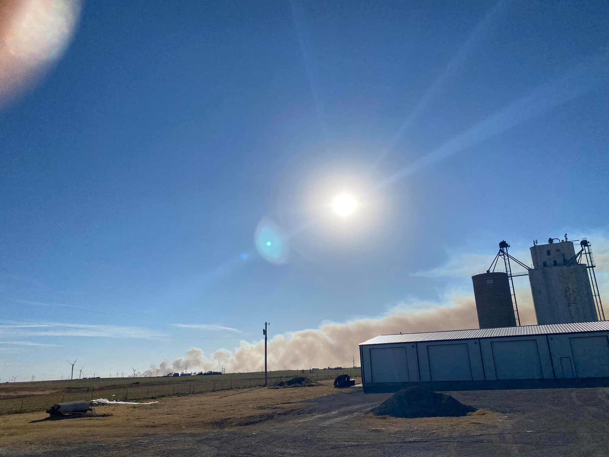
Finally, we didn’t have any major fires here in the county yesterday but we were able to send our Task Force over to Ames to assist them with their fire. Departments that were sent are as follows: Douglas Fire, Drummond Fire, Garber Fire, Hillsdale-Carrier Fire District, Kremlin Fire, Lahoma Fire, and Waukomis Fire. This looks like a lot but we had plenty of personnel available to cover anything here in our county so we sent them to help.
The picture attached was taken by Lahoma Fire Department before they were deployed out there.
STAY SAFE AND HAVE A GOOD DAY!