0310L-MONDAY OUTLOOK FROM GARFIELD COUNTY EMERGENCY MANAGEMENT-3/21/22
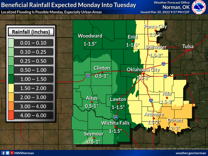
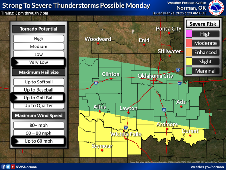
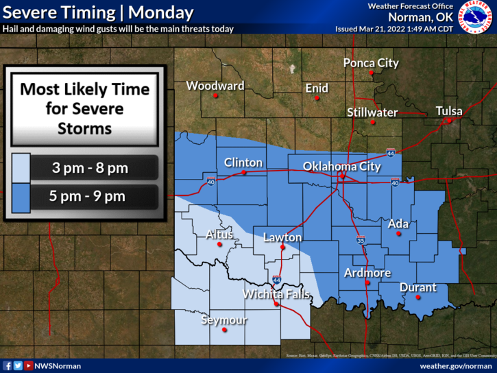
1-RAIN is possible today and tonight as a storm system moves toward the area. Timing looks to be an issue but this afternoon and tonight look to be our better chance for precipitation if we receive any. Severe weather isn’t expected. Rainfall amounts are shown in a graphic that is attached. We’ll see what happens for sure.
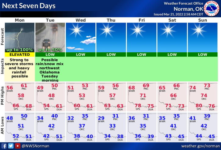
2- A cold front is expected to move through the area later this evening dropping temps and increasing winds from the north. The chance of rain will continue into Tuesday.
3- Fire conditions will be elevated but with increasing humidity, should lessen the possibility of widespread fires. Overall, we should be ok. That said, here is your forecast from the NWS/NORMAN;
Monday-Showers likely in the morning, then a slight chance of thunderstorms in the afternoon. Much cooler. Temperatures in the lower 50s. Southeast winds 10 to 15 mph with gusts up to 25 mph. Chance of rain near 100 percent.
Monday Night-Showers with a chance of thunderstorms in the evening and overnight. Lows in the upper 30s. East winds 10 to 15 mph with gusts up to 25 mph, becoming north 15 to 20 mph with gusts up to 35 mph after midnight. Chance of rain near 100 percent.
HAVE A GOOD DAY!