0425L-MONDAY UPDATE FROM ENID/GARFIELD COUNTY EMERGENCY MANAGEMENT-3/26/18
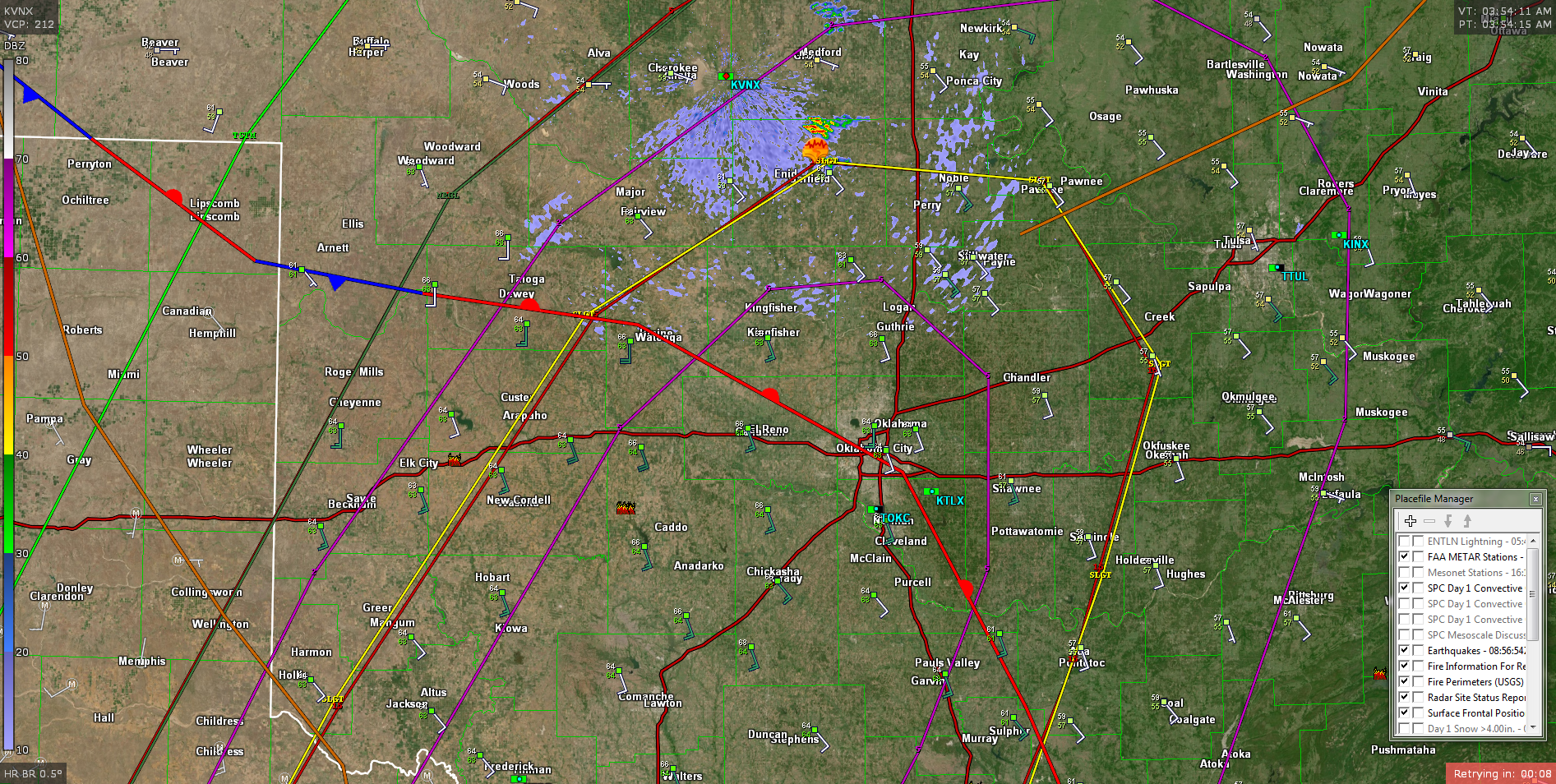
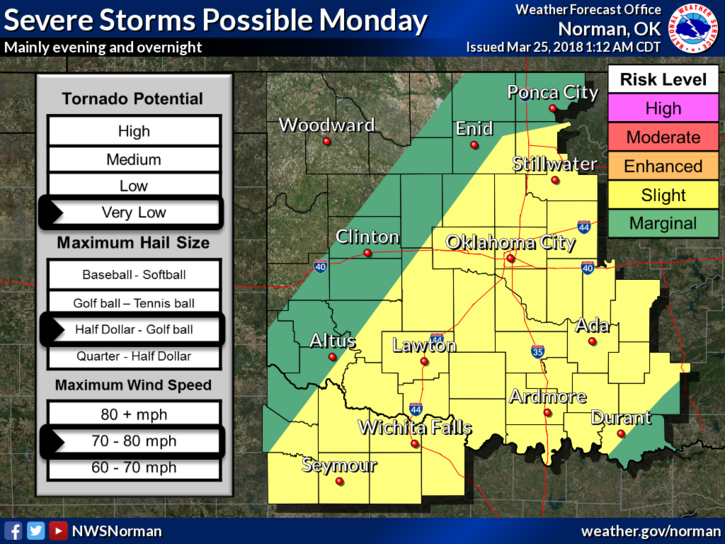
1- We are in a SLIGHT RISK for severe weather later today. As stated last night, the main risks are large hail, damaging winds and isolated tornadoes. If you look at the radar pic below, the purple circle in the middle is a 5% tornado probability. The yellow line is the slight risk area. The red line with the slight risk is a 15% hail risk. The other larger purple line is a 2% tornado risk. The dark green line is the marginal risk and the outside red line is a 5% hail risk area. The light green line is a general TSTM RISK. Welcome to my world.
2- It may be an interesting afternoon and evening but realize that all of our spotters and operations center personnel will be briefed and will be on standby alert status today and tonight.
3- There are some communication issues, internet wise, this morning but they should be resolved soon. Either way, I’ll keep the information flow going through our GARFIELD COUNTY EM app as the day wears on. Remember, have 3 WAYS of getting information as we move deeper into the spring storm season. Be sure and listen to our LOCAL RADIO STATIONS TOO.
4- No reason to worry and get hyper about anything right now. We’ll see where everything comes together as the day continues. Lines on this radar pic WILL change some during the day.
5- Here is your forecast from the NWS/NORMAN;
Monday-30 percent chance of showers and thunderstorms, mainly after 7am. Areas of fog before 10am. Otherwise, cloudy, with a high near 78. South southeast wind 15 to 17 mph, with gusts as high as 24 mph.
Monday Night-40 percent chance of showers and thunderstorms. Cloudy, with a low around 50. Southwest wind 9 to 11 mph becoming northeast after midnight.
HAVE A GOOD DAY!
MIKE