0430L-SUNDAY UPDATE FROM ENID/GARFIELD COUNTY EMERGENCY MANAGEMENT-3/25/18
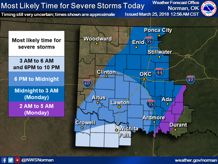
1- BOUNDARIES are the culprits this morning for forecast possibilities. A cold front, a warm front, a developing surface low, and a storm system to our southwest throw many sticks in the spokes, so to speak. Exact timing will be a nightmare until storms actually form. There are some good ideas but we’ll see where this actually occurs.
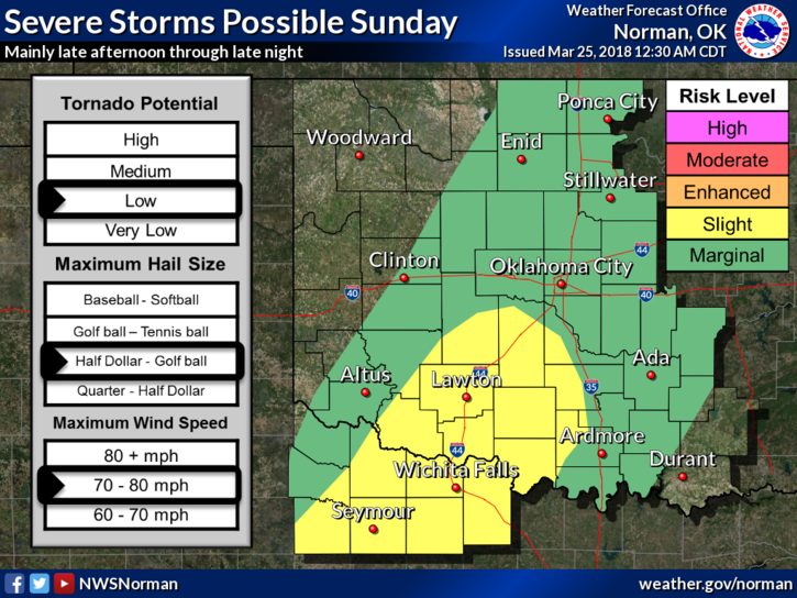
2- The area is in a MARGINAL RISK for severe weather later this evening and overnight. SEE GRAPHICS. Our risks, if storms occur, will be hail and wind. The tornado risk is “very low.” Take the time to enlarge and read the graphics. There is good info on these.
3-Monday, we are on the borderline between Marginal and Slight in our risk criteria. Keep in mind that the lines on these maps are fluid meaning they will shift around as the forecast modifies. Just don’t get fixated on where the lines are right now. They will change!!
4- Overall, we’ll be ok. We need the rain. I will send information out over the GARFIELD COUNTY EM app as needed today and it forwards to the Enid/Garfield County Emergency Management Facebook page. Those on my personal page should find @EGCEM on Facebook and follow that page.
5- Here is your forecast from the NWS/NORMAN;
Sunday-Slight chance of showers & thunderstorms after 9am. Mostly cloudy, with a high near 61. East wind 10 to 15 mph. Chance of precipitation is 20%.
Sunday Night-40 percent chance of showers and thunderstorms, mainly after 1am. Mostly cloudy, with a low around 58. East southeast wind 10 to 20 mph, with gusts as high as 25 mph.
I’ll advise as needed. Have a great day!!
Mike