FROM GARFIELD COUNTY EMERGENCY MANAGEMENT
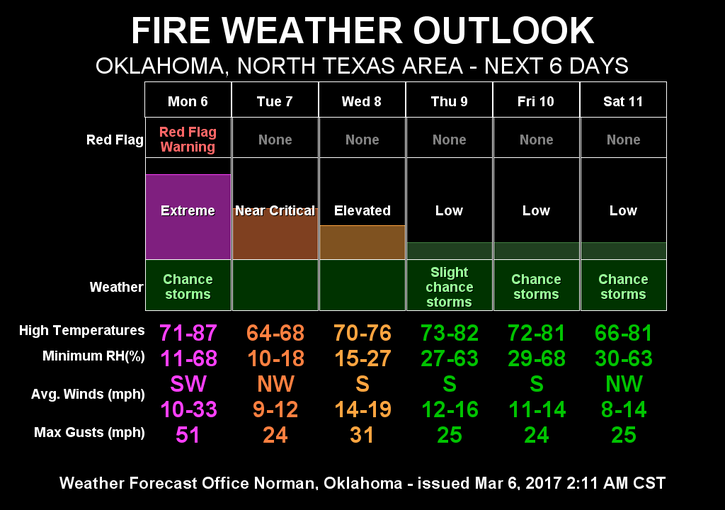
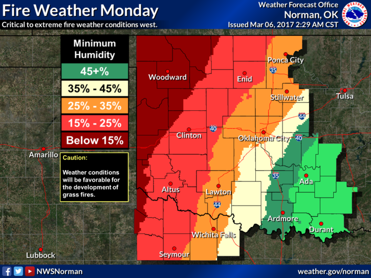
WE ARE IN A RED FLAG FIRE WARNING TODAY FROM 11AM UNTIL 8 PM TONIGHT. You all know the drill on this one. I will state this now-NO CONTROLLED BURNING TODAY AT ALL. If you start a fire and it gets out of control, you may be billed for the response and you will pay for any damage to other folks property. We are NOT in a burn ban BUT PLEASE use common sense. We appreciate it.
WE ARE ALSO IN A WIND ADVISORY TODAY FROM 10 AM UNTIL 7 PM TONIGHT. This means that we can expect sustained winds of 25-35 mph gusting to as high as 45 mph.
This is EMERGENCY MANAGEMENT WEEK and as stated last week, I will post the first of 5 videos around mid-morning today with the first topic –PREPAREDNESS. I will post 1 each day
Here is your forecast from the NWS/NORMAN;
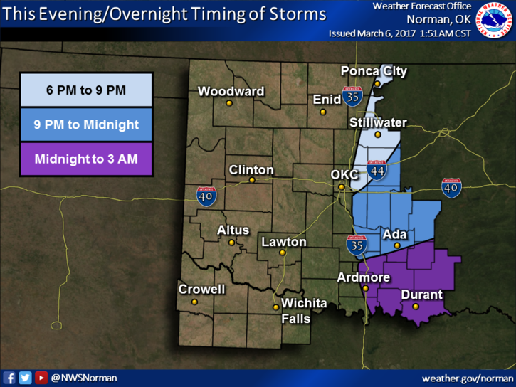
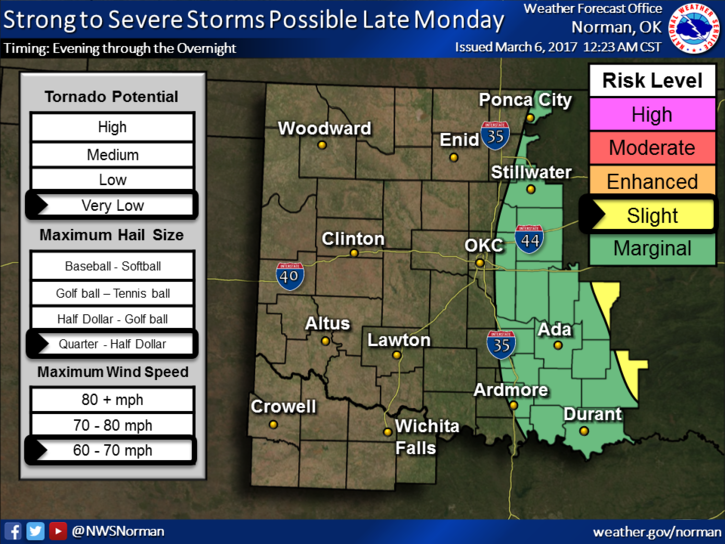
Monday-Patchy drizzle and fog before noon. Mostly cloudy, then gradually becoming sunny, with a high near 81. Windy, with a south wind 23 to 33 mph becoming west in the afternoon. Winds could gust as high as 47 mph.
Monday Night-Clear, with a low around 35. Windy, with a west wind 24 to 29 mph becoming west northwest 10 to 15 mph in the evening. Winds could gust as high as 40 mph.
HAVE A SUPER DAY!!
MIKE