0350L-MONDAY OUTLOOK FROM GARFIELD COUNTY EMERGENCY MANAGEMENT-5/3/21
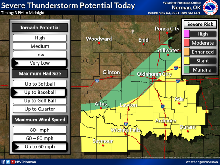
1- GENERAL RISK for thunderstorms today and later tonight. Severe weather is not expected but it can happen under general risks. The front is pushing through now so expect periods of showers and possibly a few thunderstorms through Tuesday morning.
2- Tonight we could see some heavy activity with rainfall being the main issue. If this occurs, low lying areas could become flood issues so be extremely careful while driving. We’ll watch and advise over the GARFIELD COUNTY EM app as needed and we may post on social media too. Overall, we’ll be ok.
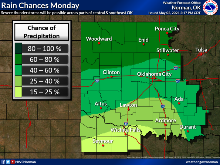
3- Here is your forecast from the NWS/NORMAN;
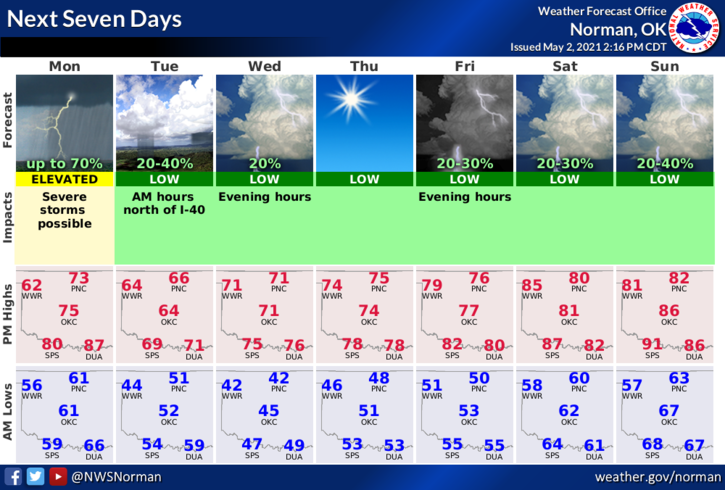
Monday-Mostly cloudy. A slight chance of thunderstorms in the morning, then a chance of thunderstorms in the afternoon. Highs in the lower 70s. North winds 10 to 20 mph with higher gusts. Chance of thunderstorms 40 percent.
Monday Night-Mostly cloudy. Rain showers likely and a chance of thunderstorms in the evening, then rain showers likely and a slight chance of thunderstorms after midnight. Cooler. Lows in the upper 40s. North winds 15 to 20 mph with higher gusts. Chance of precipitation 70 percent.
Some graphics were not updated when this was posted.
HAVE A GOOD DAY AND WE’LL ADVISE AS NEEDED.
MIKE