0310L-MONDAY OUTLOOK FROM GARFIELD COUNTY EMERGENCY MANAGEMENT-11/14/22
WINTER WEATHER ADVISORY IN EFFECT FROM 6AM THIS MORNING UNTIL 6PM TONIGHT
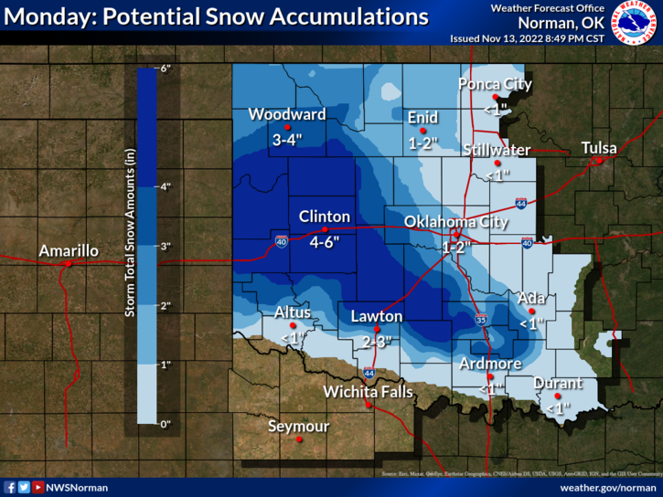
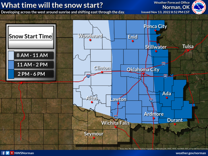
1- Snow accumulation of 1-2 inches is possible during the day. Road conditions may become hazardous so please slow down and pay attention to possible deterioration of driving conditions. Snowfall/ rain, if they do occur, should start up around mid-morning, give, or take.
2- The storm track appears to be taking more of a southern track so the center of activity should be along the I-40 corridor give or take. The northern part of the state has that chance but since we will be slightly above freezing and our thermal profile is a little dryer, snowfall may or may not occur. We’ll see what happens. Just stay weather aware and we’ll deal with what Mother Nature throws at us. FROM THE NWS–IT IS IMPORTANT TO NOTE THAT OUR SNOWFALL GRAPHICS REPRESENT A DETERMINISTIC, “ON AVERAGE” FORECAST.
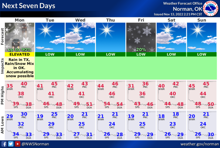
3- OVERALL, we’ll be ok so here is your forecast from the NWS/NORMAN;
Today- Cloudy with a chance of snow. A chance of rain this morning, then rain this afternoon. Highs around 40. Southeast winds 5 to 10 mph, becoming northeast this afternoon. Chance of precipitation 90 percent.
Tonight-Mostly cloudy. A chance of rain and snow in the evening. Total snow accumulation around an inch possible. Cold with lows in the mid-20s. Northwest winds 5 to 10 mph. Chance of precipitation 50 percent.
HAVE A GOOD DAY!