0330L-SUNDAY OUTLOOK & INFO FROM GARFIELD COUNTY EMERGENCY MANAGEMENT-11/13/22
1-Being prepared is easy if you have our app and actually read through the YOUR EMERGENCY icon. Lots of great info to learn, know, and apply. Download our GARFIELD COUNTY EM app today.
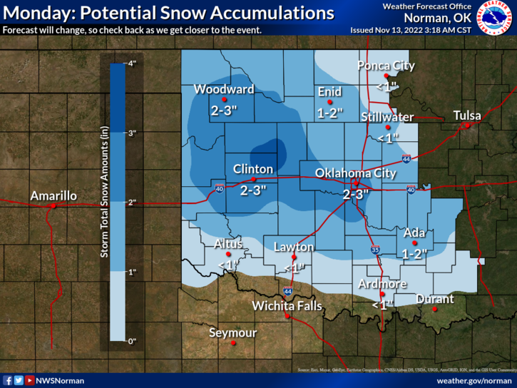
2- We have a WINTER WEATHER EVENT coming. The graphs that will be attached are NOT set in stone. Storm track is NOT set in stone either. Models are not in total agreement and thermal profiles are changing run to run. Here are some facts:
a-We may see rain, rain/snow mix, or just snow depending on if the atmosphere cools enough- the thermal profiles stated in #2 above.
b-If we see snow, per guidance right now, we could see accumulations of 1-2 or 2-3 inches and this WILL CHANGE several times between now and Monday depending on the actual storm track which continues to change over time. Actual storm track will be determined as the system moves across the region. I know this sounds like a cop-out but winter storms are very hard to nail down per guidance.
c-We will remain cold and we’ll see several opportunities for rain or snow a few times this week.
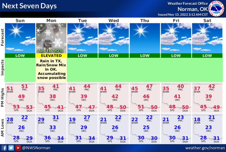
3- WEATHER-WISE for today, enjoy the abundant sunshine And warmer temps. They will be short lived. OVERALL, we’ll be ok so here is your forecast from the NWS/NORMAN;
Today-Sunny. Highs in the lower 50s. Southeast winds 15 to 20 mph with gusts up to 30 mph.
Tonight-Partly cloudy in the evening, then becoming mostly cloudy. Cold with lows in the lower 30s. Southeast winds 10 to 15 mph.
HAVE A GOOD DAY!