0405L-MONDAY OUTLOOK & INFO FROM GARFIELD COUNTY EMERGENCY MANAGEMENT-11/25/19
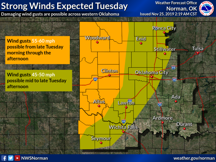
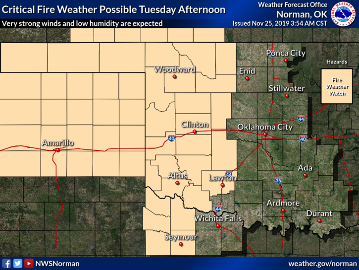
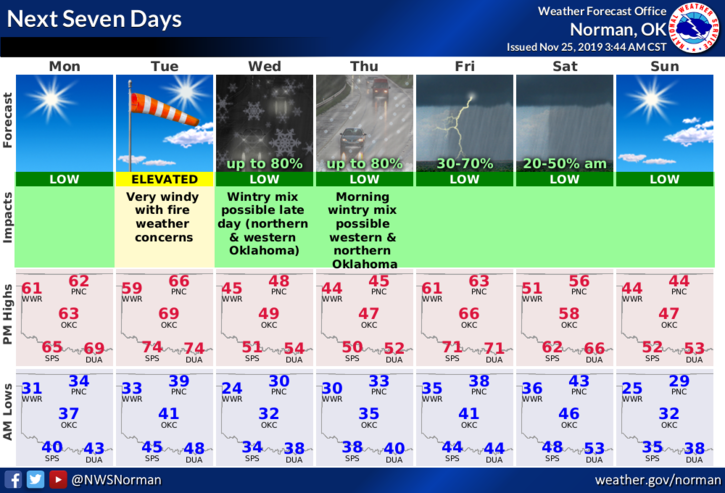
1- Enjoy today as it will be similar to yesterday with light winds and sunshine. Tuesday will be a different story with high winds, warm temps, and lower humidity. The FIRE DANGER will increase dramatically. If anyone has any burning to do, do it today and make sure it’s out by dark, tonight. All fire departments around the region should be on HIGH ALERT as any fires that start after the winds increase on Tuesday, could get out of control very quickly.
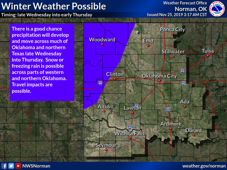
2- A surface trough will push through the area today shifting winds to the NW which will keep us warm and dry. A stronger storm system moves out of the Rockies tomorrow and will track over northern Kansas. Tomorrow, as stated above, windy, Wednesday-a lull between systems then Thursday through the weekend looks interesting. We’ll keep an eye on the guidance and go from there. You can read the NORMAN & WICHITA discussions on their websites. You can find them here: https://gcem.org/links/ on the right side of the page.
3- That said, here is your forecast from the NWS/NORMAN;
Monday-Sunny with a high near 61. Northwest winds 5 to 10 mph becoming northeast in the afternoon.
Monday Night-Partly cloudy, with a low around 36. Northeast wind around 10 mph.
HAVE A SUPER DAY!!
MIKE