0345L-TUESDAY OUTLOOK & INFO FROM GARFIELD COUNTY EMERGENCY MGMT-11/26/19
Get our notification app GARFIELD COUNTY EM. You’re not prepared without it.
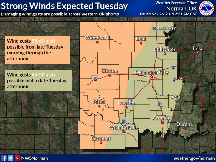
RED FLAG WARNING in effect for the western 1/3rd of Oklahoma. Timing is from 11am until 6 pm today. If traveling, use extreme caution.
HIGH WIND WARNING in effect for the same area except GARFIELD & GRANT CO. included. Timing is from noon until 9pm tonight.
1- Very strong winds are expected today. If anyone was burning trash or burn pits yesterday, make sure they are completely extinguished before leaving the property. One spark is all it will take today to have a major issue. If ANYONE sees any smoke or fire, call 911 immediately.
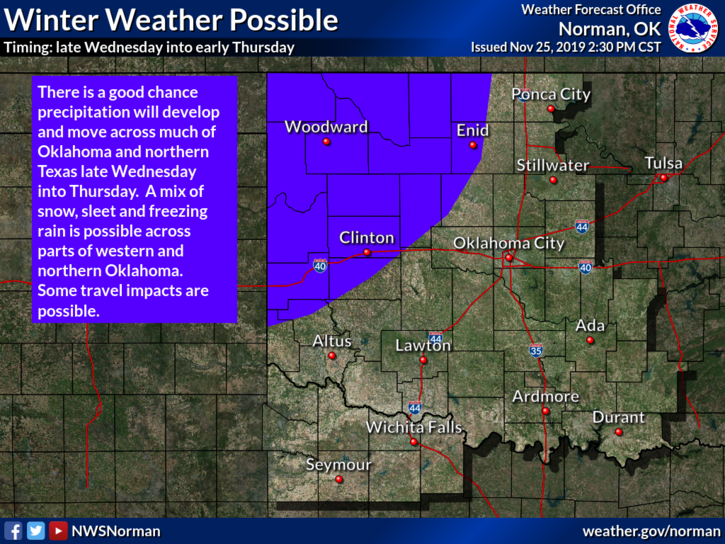
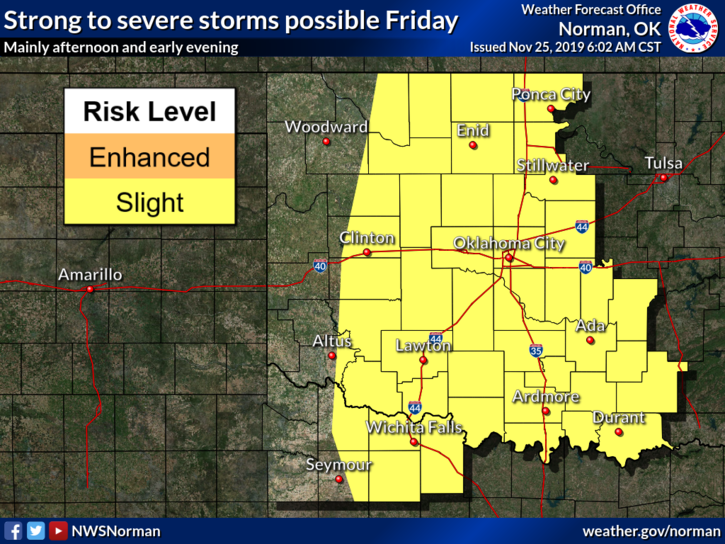
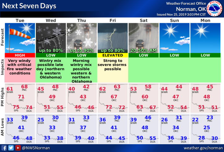
2- A quick outline for this week- Today-HIGH WINDS, Wednesday-possibly winter weather during the night, Thursday- if it occurred, winter weather continues, otherwise, rain, Friday- SLIGHT RISK for severe weather. Other than this, a normal week. J
3- Concerning the winds for today- strong winds will whip power lines and there may be some outages around the area. If this occurs, call OGE-800-522-6870 and please be patient. I understand it’s inconvenient but many MIGHT be affected.
4- Here is your forecast from the NWS/NORMAN;
Tuesday-Partly cloudy. Windy. Highs in the upper 60s. South winds 10 to 15 mph increasing to southwest 25 to 35 mph with gusts to around 50 mph in the afternoon.
Tuesday Night-Clear. Lows in the upper 20s. West winds 15 to 25 mph.
Finally, if fires do occur, please stay out of the areas as fire units will be moving very quickly to get a handle on the situation. Thanks
HAVE A GREAT DAY!!
MIKE