0320L-MONDAY OUTLOOK FROM GARFIELD COUNTY EMERGENCY MANAGEMENT-10/17/22
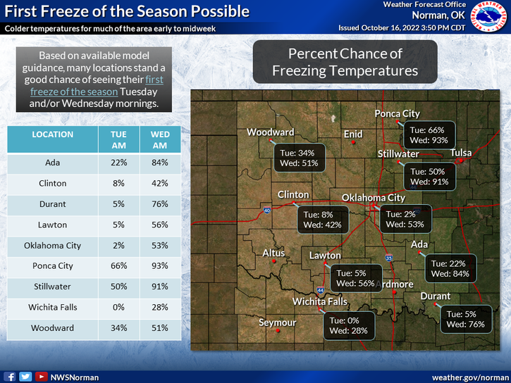
FREEZE WATCH IN EFFECT TONIGHT AND TUESDAY NIGHT. GET PREPARED WITH OUR GARFIELD COUNTY EM APP. You’re not prepared without it.
1- COLDER TEMPERATURES ARE HEADING OUR WAY. We are expecting freezing temps or close to freezing temps tonight and then below freezing temps overnight Tuesday night into Wednesday morning. This will be a hard freeze also known as a killing freeze. Tender vegetation will die if precautions aren’t taken. We’ll see what happens. You all may want to dust off the jackets and coats. DISCONNECT WATER HOSES FROM THE HOUSE!
2- The Fire Danger will continue to be elevated as drier air continues to filter in. This will lower dew point temps and relative humidity so use extreme caution while utilizing anything related to fire. We continue to monitor our arson situation out in the county areas. Please report anything that looks suspicious to the Sheriff’s office or 911.
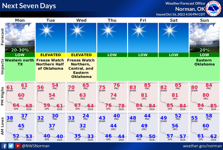
3- Overall, we’ll be ok, just cold for a bit. Stay warm, stay alert, stay safe. Here is your forecast from the NWS/NORMAN;
Today- Sunny. Highs in the lower 60s. North winds 10 to 15 mph.
Tonight- Clear, cold with lows in the lower 30s. North winds 5 to 10 mph.
HAVE A GOOD DAY.