0310L-TUESDAY OUTLOOK FROM GARFIELD COUNTY EMERGENCY MANAGEMENT-10/18/22
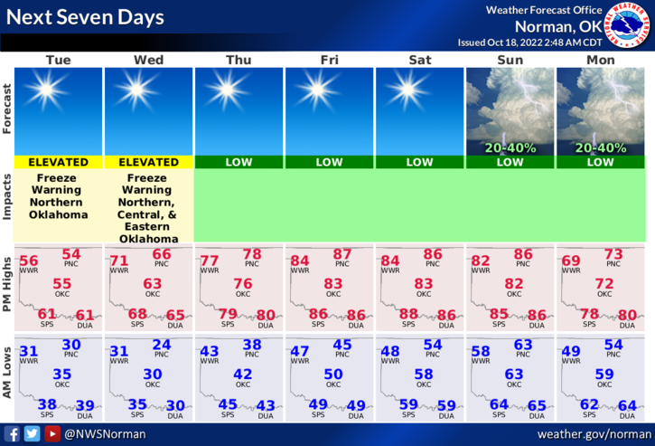
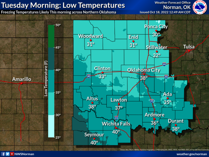
1- FREEZE WARNING IN EFFECT UNTIL 9AM THIS MORNING AND AGAIN TONIGHT FROM 11 PM UNTIL 9 AM WEDNESDAY MORNING.
2- Cold early then cool for the rest of the day with light northerly winds. Tonight, as the surface high centers itself over us, winds will drop down, humidity will be low and we’ll have great radiational cooling meaning that a hard freeze will be likely with lows in the upper 20’s. Don’t worry folks, we’ll warm back up this weekend to highs in the 80’s. We’ve entered into the battle for the seasons.
3- Overall, we’ll be ok so here is your forecast from the NWS/NORMAN;
Today- Sunny. Highs in the mid-50s. North winds 5 to 10 mph.
Tonight- Clear, cold with lows in the mid-20s. Northeast winds 5 to 10 mph, becoming southeast after midnight.
FINALLY- KEEP THAT EYE OUT FOR SUSPICIOUS ACTIVITY.
HAVE A GOOD DAY!