0355L-MONDAY UPDATE FROM ENID/GARFIELD COUNTY EMERGENCY MANAGEMENT-10/8/18
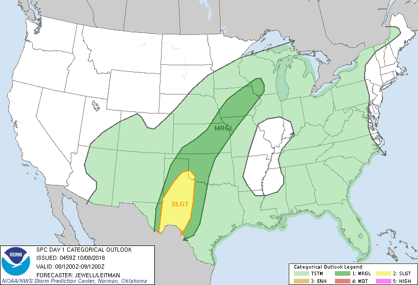
1- We are in a MARGINAL RISK for severe weather today. The cold front that came through on Friday will push back north today as a warm front. We will face a few more rounds of rain today through Tuesday. We’ve received at least 3 inches of rainfall. Let me know your totals.
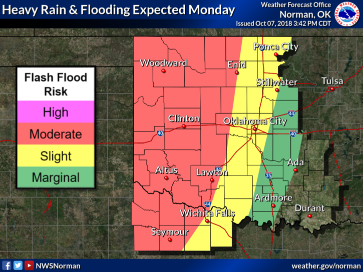
2- We are in a flood watch though Tuesday. If we receive a lot more rain today, flooding may occur as it probably already has in low lying areas. USE EXTREME CAUTION DRIVING ESPECIALLY IN AREAS PRONE TO FLOODING.
3- I will send out advisories through our GARFIELD COUNTY EM app as needed today too.
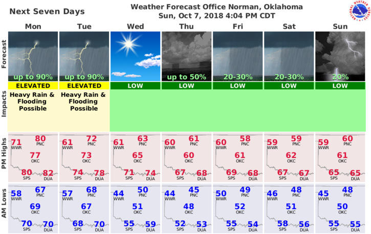
4- Here is your forecast from the NWS/NORMAN;
Columbus Day-Showers and thunderstorms. High near 77. South wind 11 to 17 mph, with gusts as high as 24 mph. Chance of precipitation is 80%. New rainfall amounts between a tenth and quarter of an inch, except higher amounts possible in thunderstorms.
Monday Night-Showers and thunderstorms. Low around 65. South wind 9 to 11 mph. Chance of precipitation is 90%. New rainfall amounts between 1 and 2 inches possible.
HAVE A GOOD DAY!!
MIKE