0415L-SATURDAY OUTLOOK & INFO FROM GARFIELD COUNTY EMERGENCY MGMT-4/18/2020
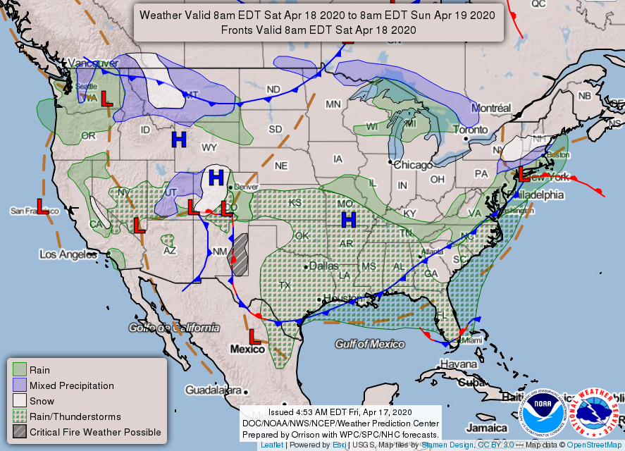
1-FROST ADVISORY FROM 4 AM UNTIL 9 AM THIS MORNING. We will gradually warm up into at least the mid-60s with south winds. Wind gusts upwards of 25 mph are possible. At least we’re going to be a little warmer today. A trough will push through the area this evening and overnight shifting the winds from southerly to northerly with a slight chance for rain. We’ll see how this comes together. Temps on Sunday should remain the mid to upper 60s.
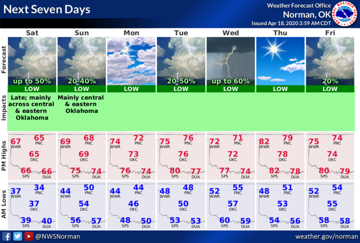
2- Here is your forecast from the NWS/NORMAN;
Saturday-Areas of frost before 7am. Otherwise, mostly sunny, with a high near 64. South wind 6 to 11 mph increasing to 13 to 18 mph in the afternoon. Winds could gust as high as 25 mph.
Saturday Night-30 percent chance of showers and thunderstorms, mainly after 1am. Mostly cloudy, with a low around 49. South southeast wind 7 to 17 mph, with gusts as high as 24 mph.
DIRECTOR’S COMMENT
SHORT AND SWEET TODAY; Storm season is coming. It’s up to you to make sure you and your family are prepared. Download our GARFIELD COUNTY EM app as it’s loaded with great info and visit our gcem.org website. Here is a link to our PREPAREDNESS GUIDE- https://gcem.org/wp-content/uploads/2019/05/FamilyPreparednessGuide2019.pdf
You can never say we didn’t give you the tools needed to be ready. PREPAREDNESS STARTS WITH YOU.
HAVE A GREAT DAY!!
MIKE