0415L-SUNDAY OUTLOOK & INFO FROM GARFIELD COUNTY EMERGENCY MGMT-4/19/2020
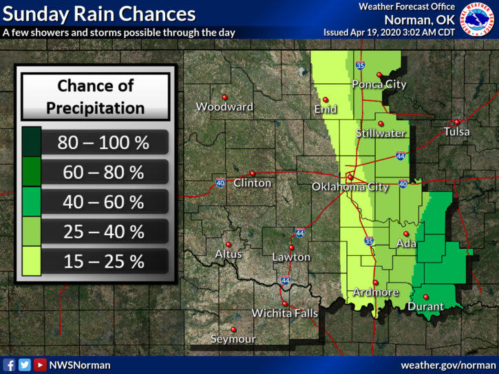
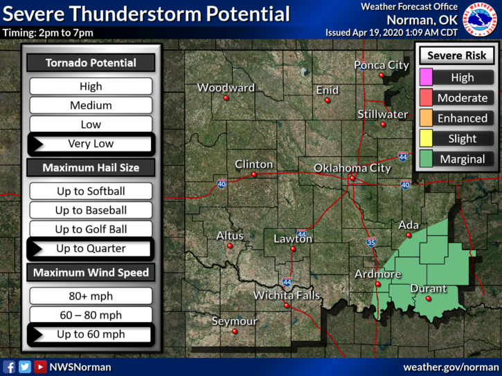
1- A trough moving across from the west and a front pushing in from the north will give us a chance for a shower/storm today. We are not expecting anything severe but we’ll see what happens. The higher threat for anything severe looks to be in southeast Oklahoma. The front will bring in some cooler air but nothing dramatic.
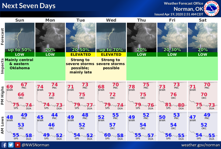
2- Severe chances go up Tuesday into Wednesday. Overall, we’ll be ok. Here is your forecast from the NWS/NORMAN;
Today-Mostly cloudy with areas of drizzle and a slight chance of thunderstorms in the morning. Patchy fog in the morning. Highs in the upper 60s. Northeast winds 10 to 15 mph. Chance of thunderstorms 20 percent.
Tonight-Partly cloudy with lows in the lower 40s. East winds up to 10 mph in the evening becoming light and variable.
No Director’s Comment today. I would probably get into trouble based on what I am researching. More on this tomorrow.
HAVE A GOOD DAY!
MIKE