0405L-SATURDAY OUTLOOK FROM GARFIELD COUNTY EMERGENCY MANAGEMENT-8/13/22
1- Are you prepared? You’re not if you don’t have our GARFIELD COUNTY EM app. It’s loaded with features that will educate you and keep you informed during good and bad weather along with information in the event we have a major situation occur around the region. It’s free, informative, so download it today.
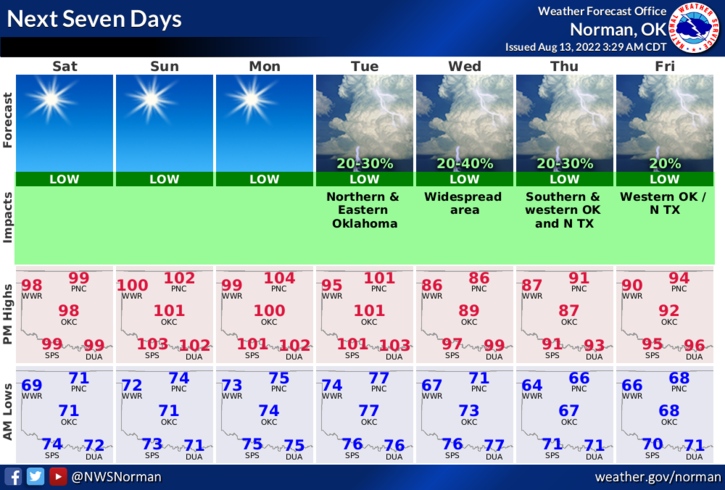
2- Here is your forecast from the NWS/NORMAN;
Today-Sunny, hot with highs around 100. South winds 5 to 10 mph.
Tonight- Clear. Lows in the lower 70s. South winds 5 to 10 mph.
3- As stated yesterday, cooler weather is forecast from Wednesday through at least the weekend with highs in the upper 80s. A cold front should arrive on Tuesday morning bringing a chance for showers and a few thunderstorms. The chances are low but we’ll take it if it can occur. Cooler temps will be the main factor as we trend towards the end of next week. We’ll see what happens.
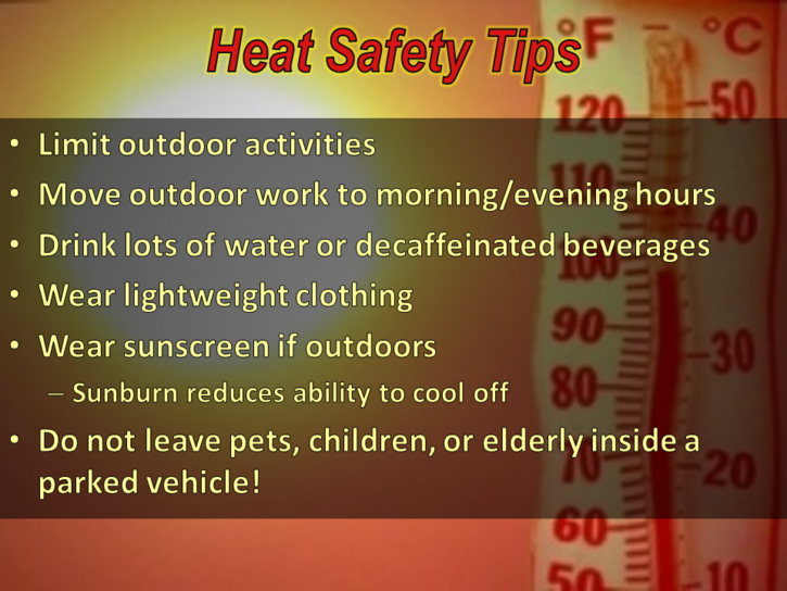
4- The FIRE DANGER is still out there so use extreme caution utilizing anything related to fire.
HAVE A GOOD DAY!!