0340L-SATURDAY OUTLOOK & INFO FROM GARFIELD COUNTY EMERGENCY MANAGEMENT-8/17/19
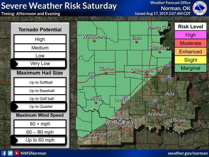
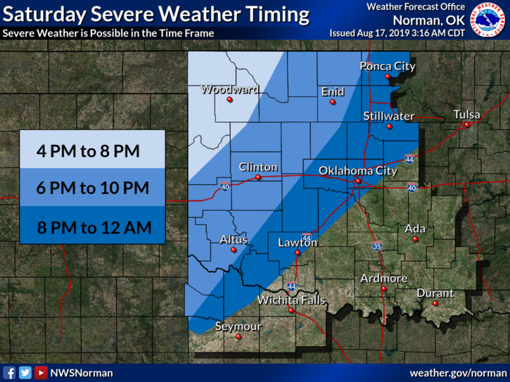
1- MARGINAL RISK for severe weather later today. If storms occur, wind and hail will be the primary threats. We’ll see what develops!!
2- Preparedness starts with our GARFIELD COUNTY EM app. Download and become familiar with it BEFORE you actually need it!! It just could save your life.
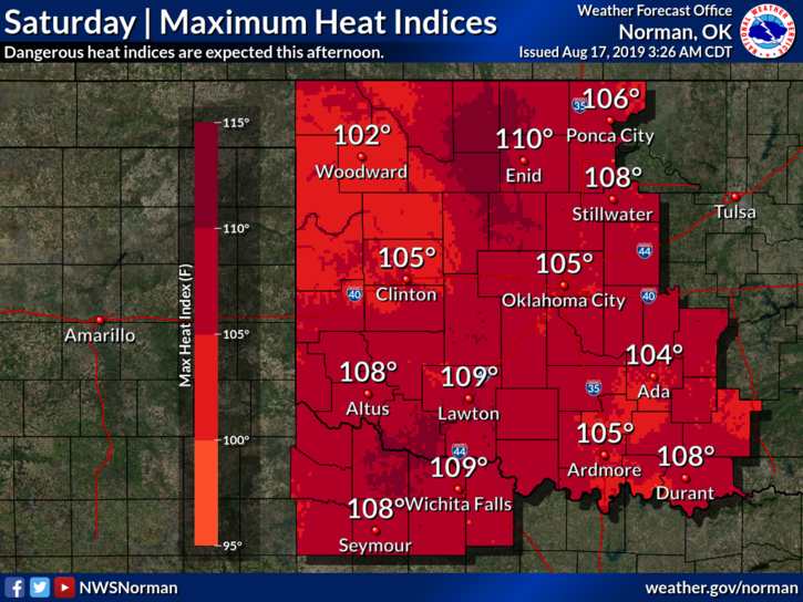
3- Oppressive heat will be around over the next several days so a HEAT ADVISORY IS IN EFFECT FROM 1PM TODAY UNTIL 9PM SUNDAY EVENING. Be careful while working outdoors and as I have stated for weeks, STAY HYDRATED with water and Gatorade “type” products.
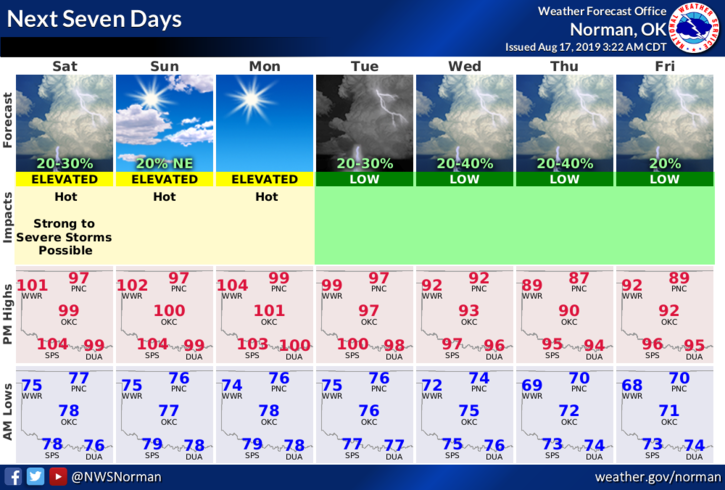
4- Here is your forecast from the NWS/NORMAN;
Saturday-Showers and thunderstorms likely before 7am then sunny and hot with a high near 100. Heat index values as high as 107. South wind 10 to 20 mph gusting as high as 25 mph. Chance of precipitation is 60%.
Saturday Night-20 percent chance of showers and thunderstorms before 1am. Partly cloudy with a low around 76. South winds 10 to 20 mph gusting as high as 25 mph.
HAVE A GOOD DAY AND STAY SAFE!
MIKE