0355L-FRIDAY OUTLOOK & INFO FROM GARFIELD COUNTY.EMERGENCY MGMT-8/16/19
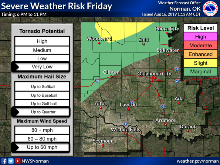
1-We are in a MARGINAL RISK for thunderstorms later tonight and overnight. IF STORMS OCCUR, wind, hail, & heavy rainfall would be the main issues. We’ll see what happens.
2- We will continue with the hot and humid weather for the foreseeable future. It is summertime so we don’t have much choice in outside temps. The heat index will still be around so stay hydrated and take breaks while working outside. Just think, in a few months we will be cooling off!!
3- Overall, we’ll be ok. If you plan on traveling to the north or northwest, check weather conditions and stay weather aware so you don’t end up in a bad situation. With all the technology out there many folks forget the basic information. Take the time to read forecasts and understand what you are reading.
4- Here is your forecast from the NWS/NORMAN;
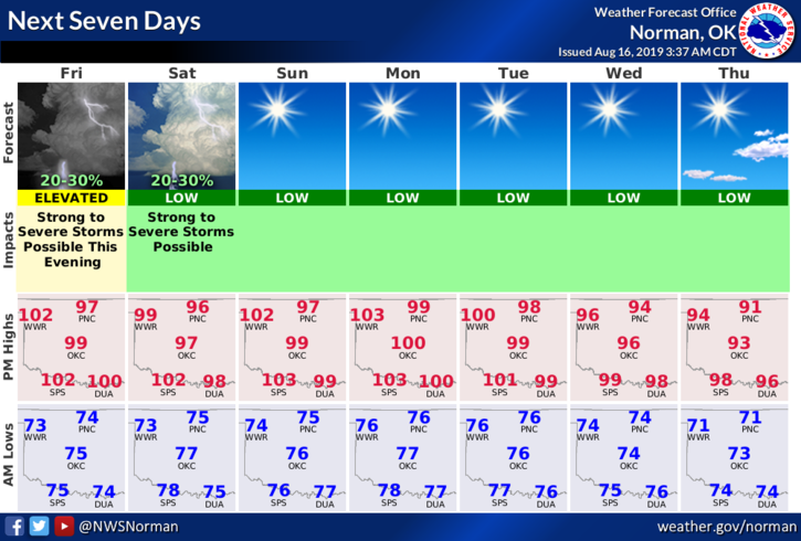
Friday- Mostly sunny and hot with highs near 102. South winds 10 to 15 mph gusting as high as 25 mph.
Friday Night-20 percent chance of thunderstorms overnight. Low around 75 with south winds 10 to 15 mph gusting as high as 20 mph.
HAVE A GREAT DAY!!
MIKE