0330L-SATURDAY OUTLOOK FROM GARFIELD COUNTY EMERGENCY MANAGEMENT-8/21/21
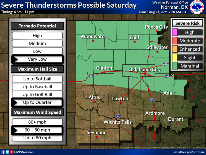
1- “MARGINAL RISK” for severe weather again later this afternoon into the evening hours. If storms occur, quarter size hail, winds upwards of 70 mph, and torrential rainfall will be our main threats along with localized flooding underneath heavier cells. Outflow boundaries from the convection in Kansas will be a focus point this afternoon just to our south. A disturbance will push northeast out of Texas into western Oklahoma and could affect us later today into tonight, thus the Marginal Risk. Many variables in the mix. We’ll see what happens.
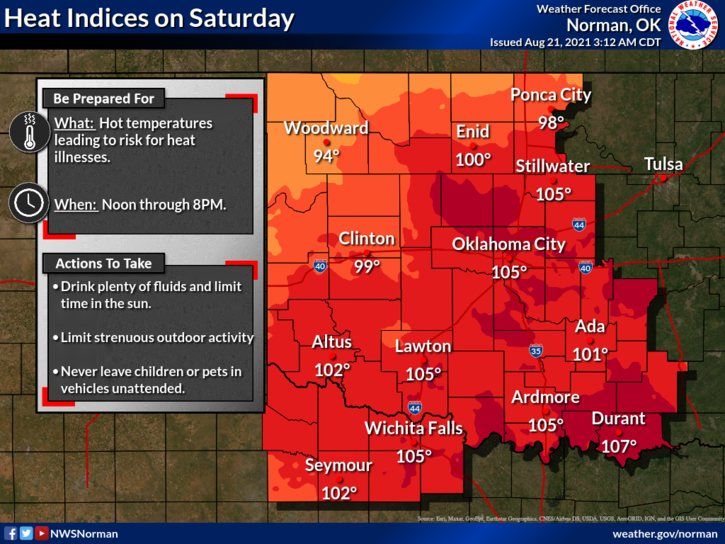
2- We will be close to HEAT ADVISORY CRITERIA today so pay attention to how you feel and stay hydrated. We’ll have the winds again to help out with this issue. Overall, we’ll be ok so stay weather aware and be extremely careful out in the heat. Here is your forecast from the NWS/NORMAN;
Today-Partly cloudy. A slight chance of thunderstorms this afternoon. Highs in the lower 90s. Northeast winds around 10 mph. Chance of thunderstorms 30 percent.
Tonight-Partly cloudy with a 40% chance of thunderstorms in the evening. Lows around 70. East winds around 10 mph in the evening becoming light and variable.
FINALLY, GARFIELD COUNTY EM is our notification app. If you don’t have it, you may need it in the near future. Download it, check it out, and apply the Preparedness information you read. You never know, IT JUST COULD SAVE YOUR LIFE.
HAVE A GOOD DAY!
MIKE