0425L-SATURDAY UPDATE FROM ENID/GARFIELD COUNTY EMERGENCY MANAGEMENT-8/25/18
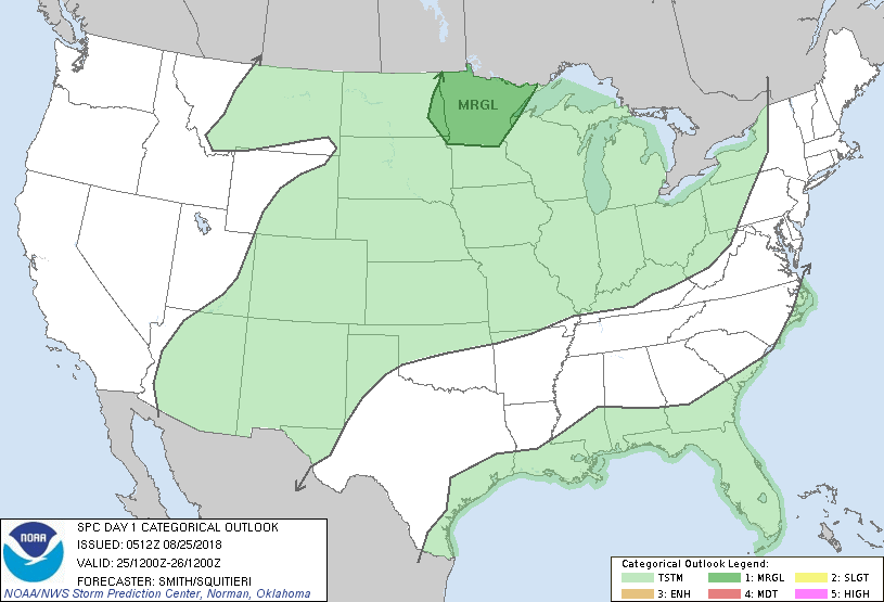
1- We remain in a GENERAL RISK for thunderstorms today but if they occur it would most likely occur early this morning or late tonight. Not expecting anything severe. Lightning, heavy rainfall, and gusty winds would be the main threats “IF” storms occur.
2-It will be “HOT” today so pace yourself while outdoors. We expect high temps in the mid 90’s with heat indices in the upper 90’s. If you travel east, the NWS/TULSA has issued a HEAT ADVISORY in their coverage area so be careful over there too.
3- Overall, we’ll be ok so just pay attention to yourself and keep an eye on the kids and others while outdoors. Don’t forget your pets too.
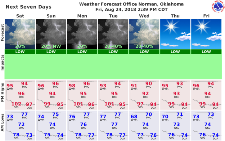
4-Here is your forecast from the NWS/NORMAN;
Saturday-30 percent chance of showers and thunderstorms, mainly before 7am. Partly sunny, with a high near 94. Heat index values as high as 97. South wind 9 to 15 mph, with gusts as high as 21 mph.
Saturday Night-Mostly clear, with a low around 74. South wind around 14 mph, with gusts as high as 20 mph.
FINALLY, make sure you have our GARFIELD COUNTY EM app. You’re NOT prepared without it.
HAVE A GREAT DAY!!
MIKE