0345L-SATURDAY OUTLOOK FROM GARFIELD COUNTY EMERGENCY MANAGEMENT-12/26/20
NOTICE- The Vance WSR-88D radar has been put into standby mode due to ground clutter suppression being inoperable. Parts are on the way but it may not be repaired until Monday or Tuesday. Don’t worry, we’ll be ok.
Download our GARFIELD COUNTY EM app. You’re NOT prepared without it.
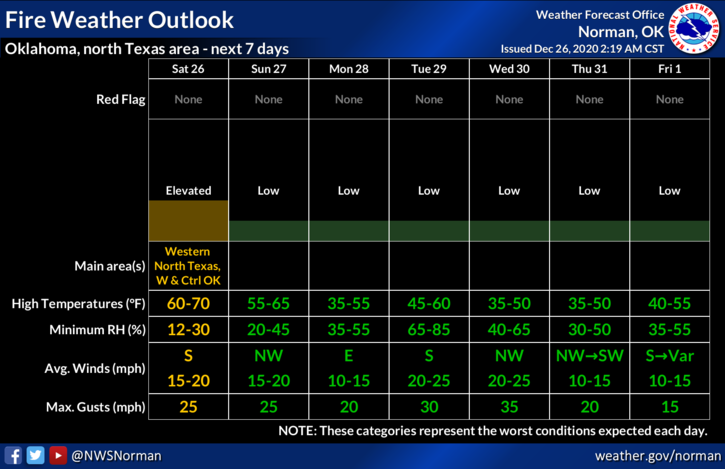
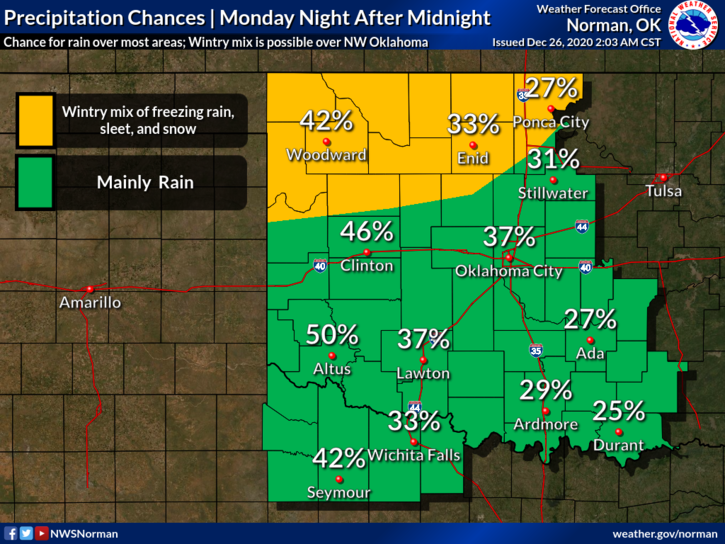
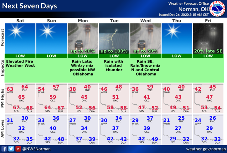
1- A surface low pressure system will be developing today over SE Colorado. It will be responsible for strong SSW winds thus increasing the Fire Danger today. We are also expecting another Front on Sunday to push through our area. A mixed precipitation event may come into play as cold air moves in from the north along with a storm system from the west in the Monday/Tuesday timeframe. TIMING will play a significant role whether we see rain, freezing rain, sleet, or snow. It’s just another winter mess to figure out.
2-Just be prepared for the above event and you’ll be ok. Temps today and Sunday won’t be too bad so get outside, while you can, and enjoy the warmth. Overall, we’ll just wait and see how this mess interacts and then enjoy what Mother Nature throws at us. Here is your forecast from the NWS/NORMAN;
Saturday-Sunny with a high near 64. South southwest wind 5 to 15 mph gusting to 25 mph.
Saturday Night-Clear with a low around 33. South wind 10 to 15 mph.
HAVE A GOOD DAY!!
MIKE