0425L-FROM GARFIELD COUNTY EMERGENCY MANAGEMENT-SATURDAY-12/30/17
Here is my personal forecast based on everything I have read since 3 am: BRRRRRRRRRR!! It won’t be back above freezing until at least next Wednesday 1/3/18.
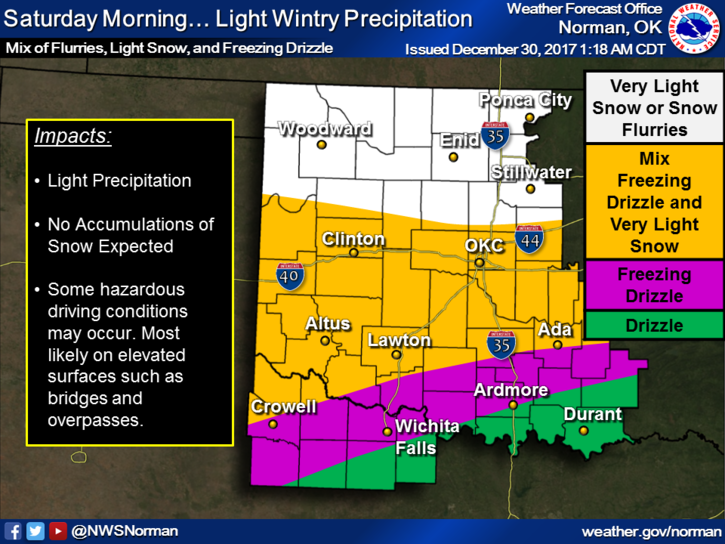
Effects of the cold front are very apparent right now and the wind is making a statement. Wind chill is 5 degrees right now so be careful and cover up as I stated last night. There will be a surge of colder air later today into tonight. As for right now, there is a very slight chance for some light precip but that window will close, so to speak, later this morning. With that surge of colder air I mentioned for tonight it will open another window for freezing precip for late tonight and Sunday morning. It might happen, it might not.
With the precip chance as stated last night, stay alert while driving. Bridges and overpasses will be affected “IF” it occurs. Please don’t text and drive. Not paying attention full time could get you that expensive trip to the hospital. I don’t want to see that happen.
From the firefighter side of my profession, make sure the kids aren’t playing with electrical plug-ins, matches or lighters. Just remember when you were a child and got away with all the things you did wrong and didn’t get caught. It’s too cold to stand outside and watch your house burn. I have seen this happen too many times. JUST KEEP A CLOSER EYE ON THE KIDS.
HERE IS YOUR FORECAST FROM THE NWS/NORMAN;
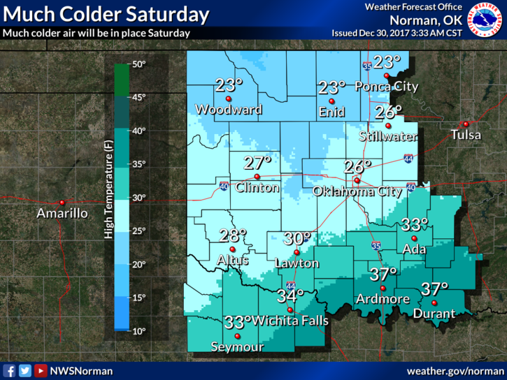
Saturday-10 percent chance of snow before noon. Partly sunny, with a high near 23. Wind chill values as low as -1. North wind 8 to 18 mph, with gusts as high as 25 mph.
Saturday Night-Partly cloudy, with a low around 9. Wind chill values as low as -3. East northeast wind 8 to 15 mph, with gusts as high as 21 mph.
I’ll advise again later today if anything chances.
Mike