0400L-FROM GARFIELD COUNTY EMERGENCY MANAGEMENT-FRIDAY-12/29/17
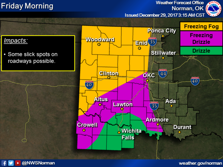
There is a possibility for freezing fog this morning so be careful and slow down out there.
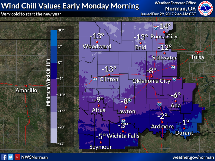
“DANGEROUS” WIND CHILL TEMPS EXPECTED THIS WEEKEND. NO DRAMA, JUST FACT. “Wind chill” issues will become prevalent Sunday and overnight into Monday morning as we could see wind chill temps down to around 10-15 below zero. That is dangerously cold. Be very careful New Year’s Eve as alcohol will affect how your body deals with the cold temperatures.
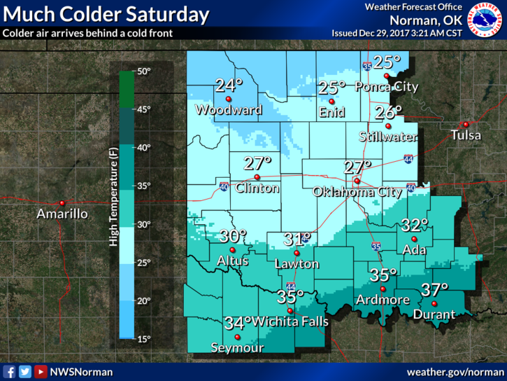
Please keep in mind that the attach graphs will change over time through the weekend as data changes. You can go to this link: https://gcem.org/links/ and keep up with changes all around the region from 11 of the NWS offices.
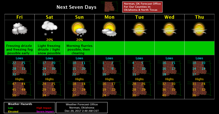
Here is your forecast from the NWS/NORMAN;
Friday-Patchy freezing fog before 9 am. Cloudy, then gradually becoming mostly sunny with a high near 44. South southwest wind 10 to 20 mph with gusts as high as 25 mph.
Friday Night-Patchy freezing drizzle after midnight. Partly cloudy, with a low around 18. Light and variable wind becoming north 10 to 15 mph in the evening. Winds could gust as high as 25 mph.
HAVE A GOOD DAY!!
MIKE