0330L-SATURDAY OUTLOOK FROM GARFIELD COUNTY EMERGENCY MANAGEMENT-1/11/2020
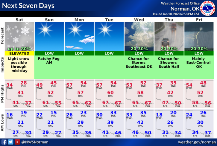
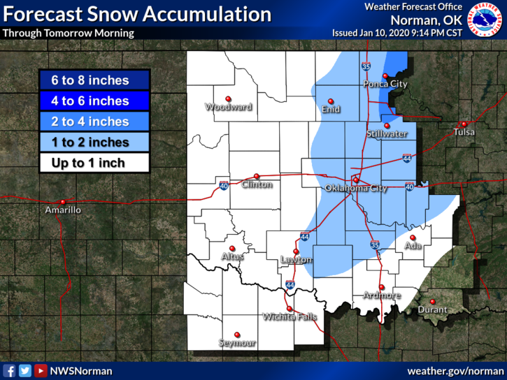
1- WINTER WEATHER ADVISORY STILL IN EFFECT UNTIL NOON TODAY. There is a slight chance we could see some snow but the dangerous issue will be the winds and of course the wind chill.
2- Overall, we’ll see clearing later today as this storm system moves to the east. Keeping this short and sweet, here is your forecast from the NWS/NORMAN;
Saturday-50 percent chance of snow before noon. Cloudy, then gradually becoming mostly sunny, with a high near 30. Wind chill values as low as zero. Windy, with a north northwest wind 15 to 25 mph decreasing to 5 to 15 mph in the afternoon. Winds could gust as high as 36 mph. New snow accumulation of less than one inch possible.
Saturday Night-Clear, with a low around 18. Light southeast wind increasing to 6 to 11 mph in the evening.
Have a good day!!
Mike