0400L-FRIDAY OUTLOOK & INFO FROM GARFIELD COUNTY EMERGENCY MGMT-1/10/2020
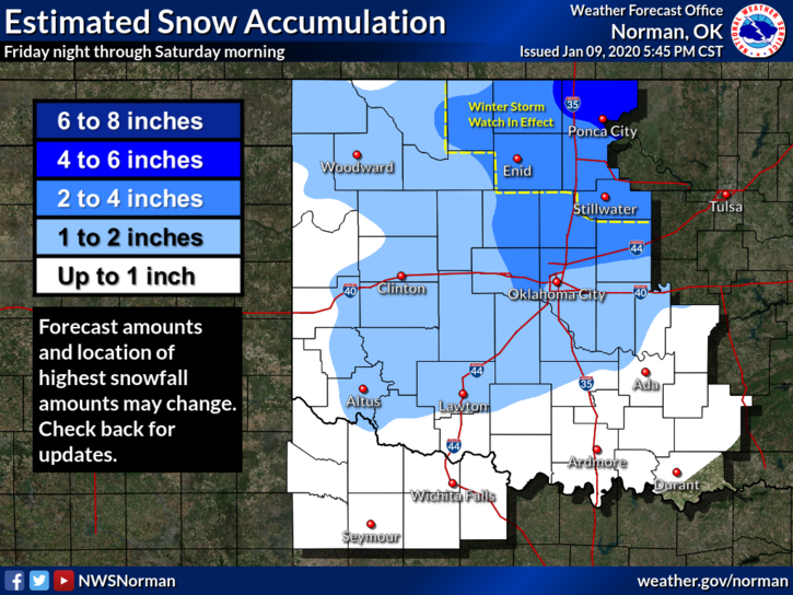
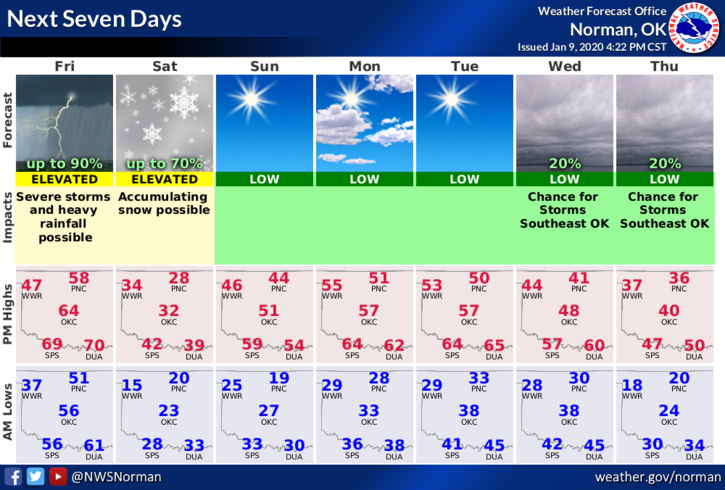
1-WINTER STORM WATCH in effect from Friday night through Saturday morning. Light ice and possibly 4-5 inches of snow possible.
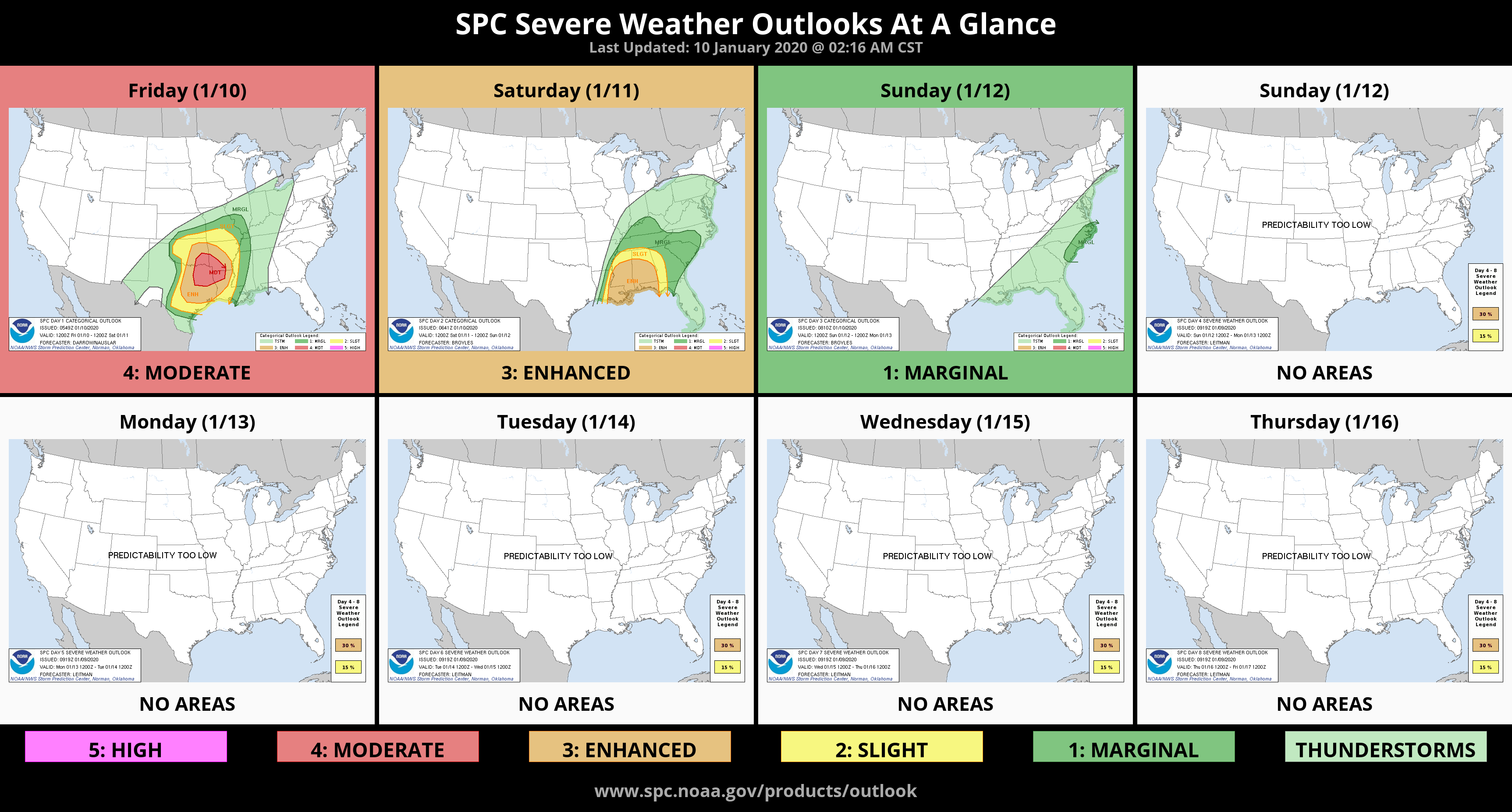
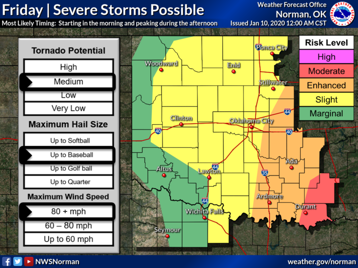
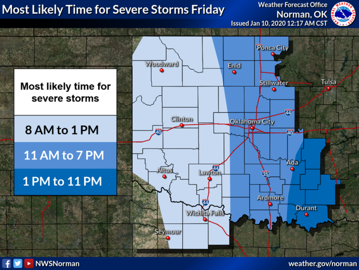
2- We are also in a SLIGHT RISK for severe weather before the winter weather occurs. If storms occur, our likely time would be from 11 am to 7 pm.
3-This said, No need to panic, we’ve seen this before. A front will push in with the severe weather threat and then much colder air will push in giving us that winter weather potential. IF you plan on traveling, pay close attention to conditions for the severe weather part of this. The higher threat will be southeast of us. Winter weather will occur tonight.
4- We’ll keep an eye out so here is your forecast from the NWS/NORMAN;
Friday-A chance of rain showers and a slight chance of thunderstorms in the morning, then thunderstorms in the afternoon. Highs in the upper 50s. South winds around 10 mph shifting to the north 10 to 20 mph in the afternoon.
Friday Night-Cloudy. Rain and light freezing rain likely in the evening, then snow likely after midnight. Much colder with lows around 17. North winds 20 to 25 mph. Chance of precipitation 60 percent.
SEE ATTACHED GRAPHICS AND HAVE A GREAT DAY!
MIKE