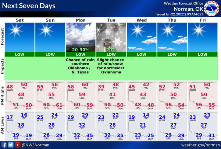
0325L-SATURDAY OUTLOOK FROM GARFIELD COUNTY EMERGENCY MANAGEMENT-1/22/22
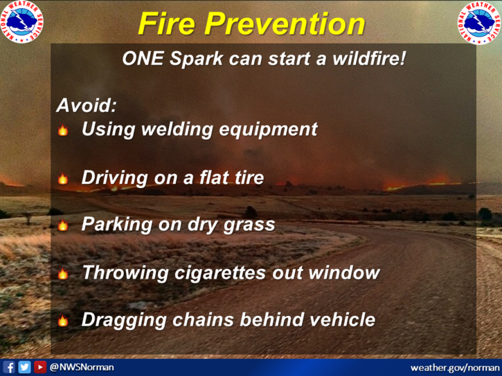
1- More of the same with cold nights and cool to warm days. We’ll have another front pushing in lowering our daytime highs back into the 40s around the Tuesday/Wednesday timeframe. Until then, the fire danger is still elevated so use extreme caution if working around anything related to fire.
2- Here is your forecast from the NWS/NORMAN;
Saturday-Partly sunny, then gradually becoming sunny, with a high near 50. West southwest wind 5 to 7 mph.
Saturday Night-Mostly clear, with a low around 25. South southwest wind 5 to 10 mph becoming west after midnight.