0340L-SATURDAY OUTLOOK FROM GARFIELD COUNTY EMERGENCY MANAGEMENT-1/30/21
1- GARFIELD COUNTY EM- I have stated all week why you need our app. Always remember that YOU are responsible for you and yours. PREPAREDNESS=RESILIENCE
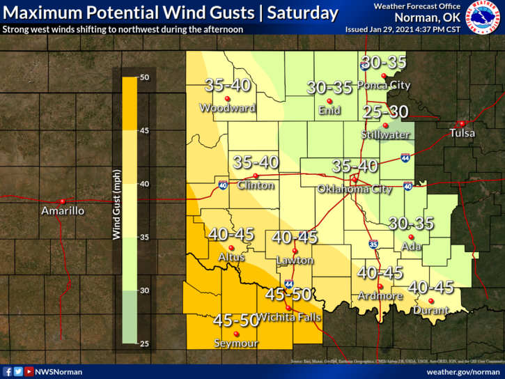
2- Warmer but mostly windy today and a front is coming towards us. The wind gradient will be very tight thus the winds. Frontal passage (FROPA) will occur around mid-day then winds will shift from southerly to northerly and ramp up to 30-40 mph with possibly higher gusts.
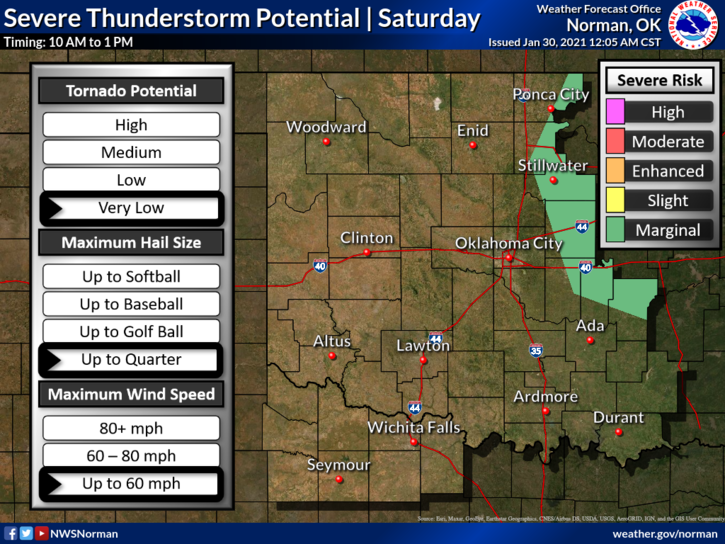
3- Overall, we’ll be ok but just be careful while driving on east/west roads. We may also have some thunderstorm activity but we don’t expect severe weather here. Here is your forecast from the NWS/NORMAN;
TODAY- Showers and thunderstorms, mainly before noon. High near 61. South wind 15 to 25 mph becoming northwest in the afternoon. Winds could gust as high as 35 mph. Chance of precipitation is 90%.
TONIGHT- Partly cloudy with a low around 32. North northwest wind 20 to 25 mph, with gusts as high as 31 mph.
HAVE A GOOD DAY!
MIKE