0400L-SATURDAY OUTLOOK FROM GARFIELD COUNTY EMERGENCY MANAGEMENT-7/10/21
Quick note: The information I post each day is derived from NWS/SPC guidance. I then put it into wording that we can all understand. 😊
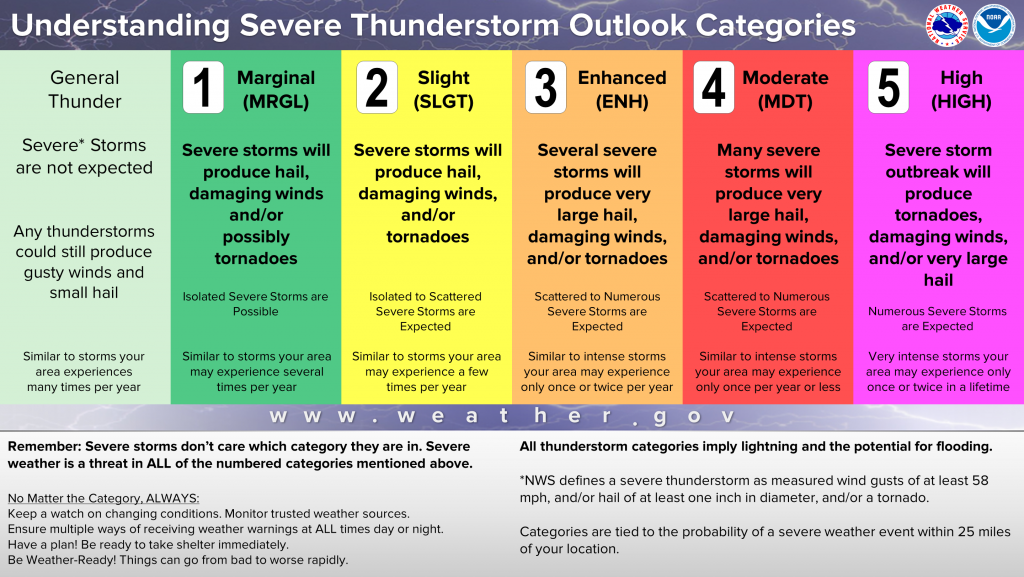
1- “ENHANCED RISK” FOR SEVERE WEATHER TODAY-see graphic on what this means below.
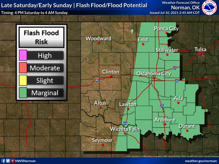
2-TIMING for storms appears to be later today through this evening-see graphic below. Graphics will change some during the day. Don’t get fixated on where the lines are as they will shift around as guidance becomes clearer.
3-Severe risk’s will be large hail, damaging winds, and torrential rainfall. The tornado risk is very low. Storms that affect our area will be capable of flooding rainfall with precipitable water values of 1.8 to 2 inches per hour. We have seen this a few times in the last 2 weeks. For drivers, SLOW DOWN. I won’t preach about this anymore and allow nature to take it course. I just hope innocent folks don’t get hurt.
4- Overall, we should be ok. The storms will move fairly quickly but areas prone to flooding when torrential rainfall occurs will most likely flood once again. Keep kids out of those water channels as it flows faster than it appears. Watch out for snakes and other critters too.
5- Download our GARFIELD COUNTY EM app as NWS WARNINGS and Advisories automatically come through the app. Here is your forecast from the NWS/NORMAN;
Saturday-Showers and thunderstorms likely, mainly after 4pm. Some storms could be severe, with damaging winds and heavy rain. Partly sunny, with a high near 94. Heat index values as high as 102. South wind 14 to 17 mph, with gusts as high as 24 mph. Chance of precipitation is 60%.
Saturday Night-Showers and thunderstorms likely, mainly before 7pm. Some of the storms could be severe. Mostly cloudy, then gradually becoming mostly clear, with a low around 66. North wind 7 to 15 mph, with gusts as high as 21 mph. Chance of precipitation is 60%.
HAVE A GOOD DAY AND WE’LL ADVISE AS NEEDED.
MIKE