0345L-SATURDAY OUTLOOK FROM GARFIELD COUNTY EMERGENCY MANAGEMENT-6/15/19
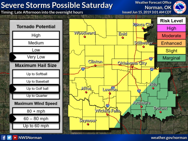
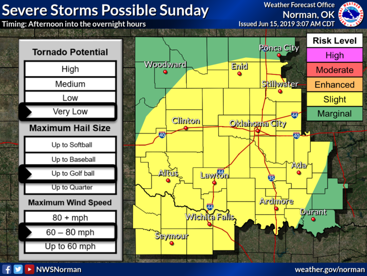
1- SEVERE THUNDERSTORM WATCH until 5am this morning. We will be in a SLIGHT RISK for severe weather again late this afternoon and overnight. Risks are golf ball size hail, winds 60-80 mph, and the tornado threat is “very low”. See attached graphs for today and Sunday. Keep in mind that these will change during the day as data-sets change.
2- The main push from storms overnight were mainly in Grant County. We are dealing with some heavy thunderstorms now-0338L- in the eastern part of the county but nothing major at this time.
3- Overall, we’ll be ok so just stay weather aware later today and tonight and we’ll advise as needed.
4- Be sure and download our GARFIELD COUNTY EM app. You’re better prepared with it than without it.
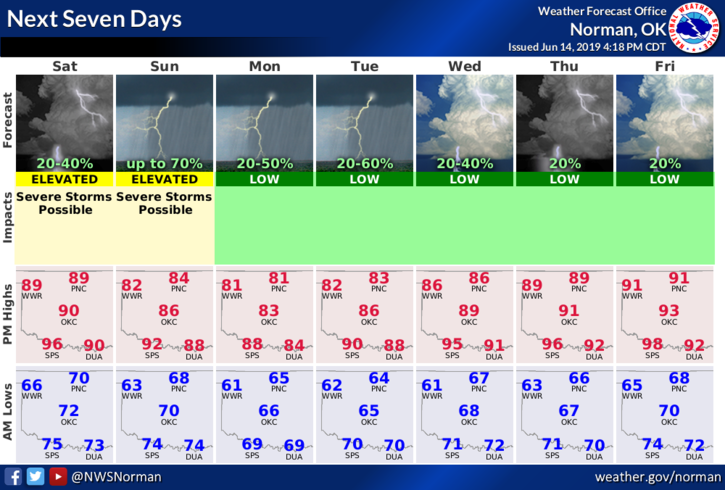
5- Here is your forecast from the NWS/NORMAN;
Today-Partly cloudy. Highs in the lower 90s. South winds 10 to 15 mph.
Tonight-Partly cloudy with a chance of thunderstorms. Lows in the upper 60s. South winds around 10 mph in the evening becoming light and variable. Chance of thunderstorms 40 percent.
HAVE A GOOD DAY!
MIKE