0355L-FRIDAY OUTLOOK FROM GARFIELD COUNTY EMERGENCY MANAGEMENT-6/14/19
GARFIELD COUNTY EM-This is our notification app. You ARE prepared with it than without it.
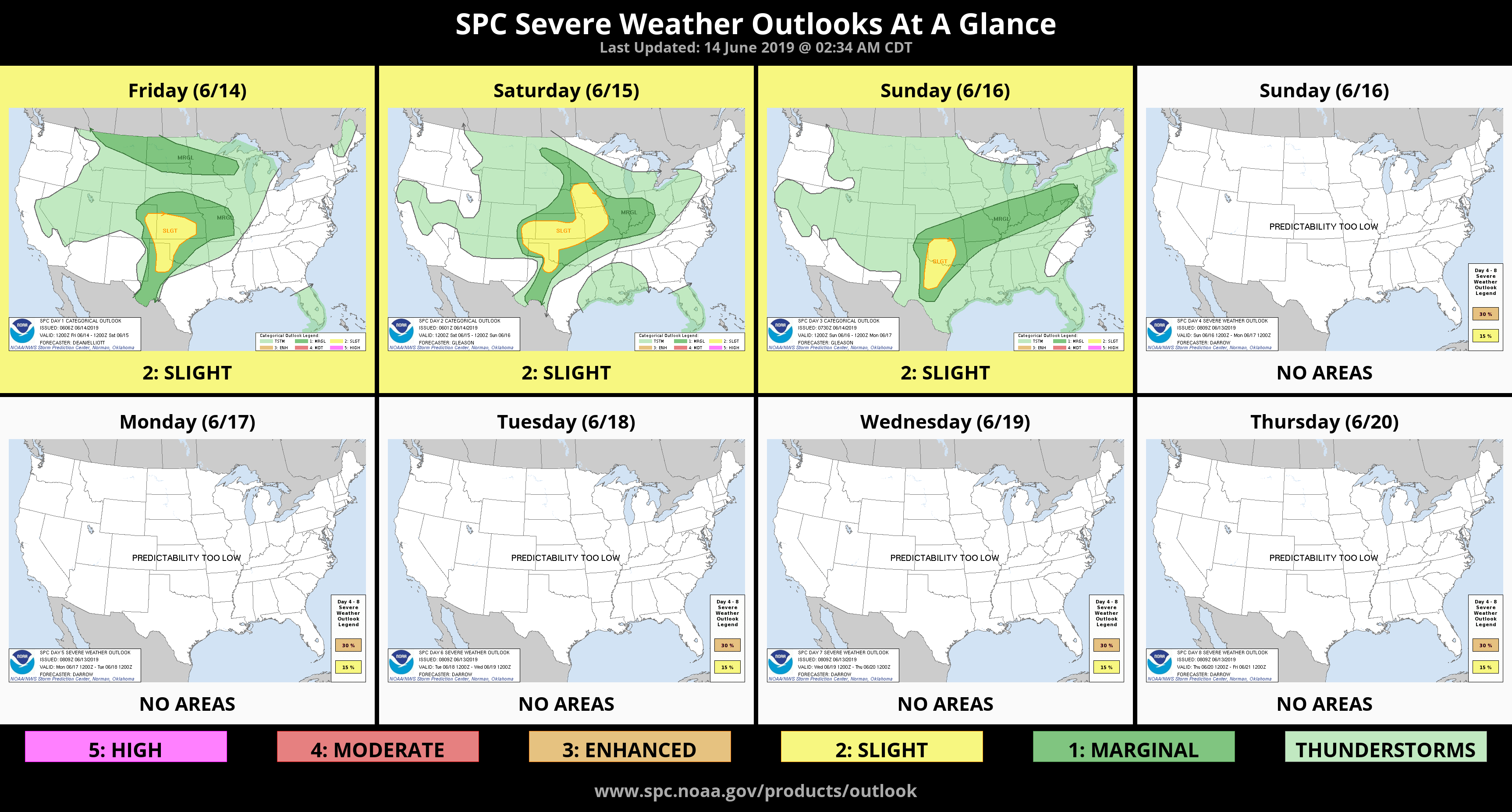
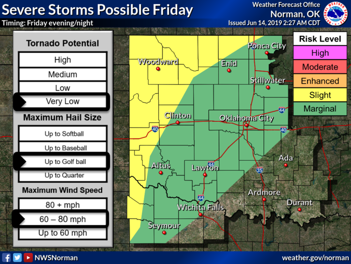
1- SLIGHT/ MARGINAL RISK for severe weather tonight into the overnight hours. As it appears at 0330L, we will be dealing with storms mainly during the overnight hours. I am aware of many activities tonight in and around the area and decisions need to be made concerning moving some of those activities inside, so I will update this later this morning as newer data arrives. See graphics attached and again, those will update throughout the day by the NWS/NORMAN.
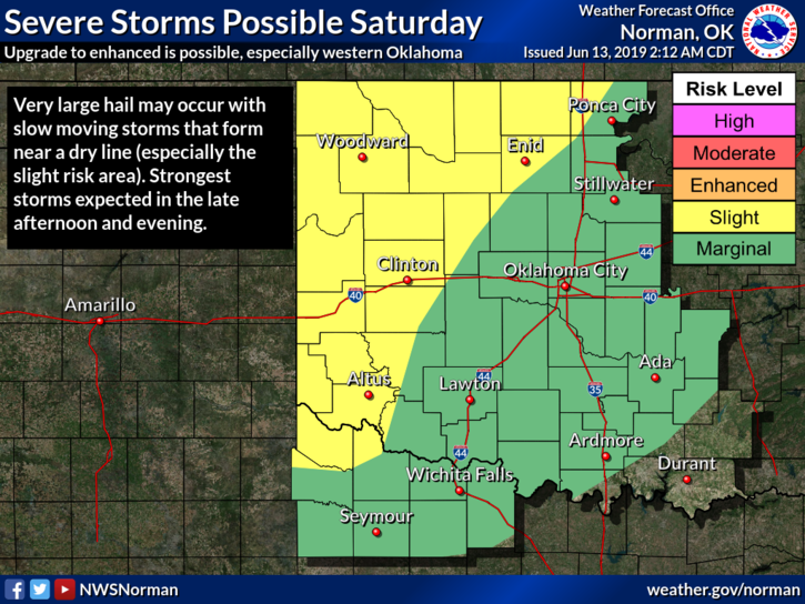
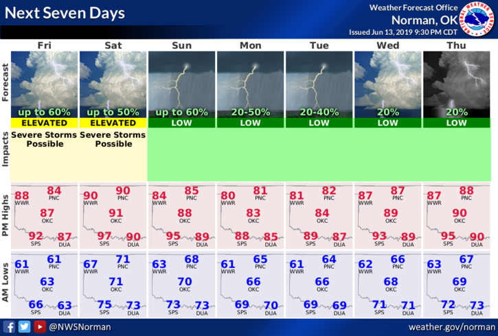
2- The weekend looks wet so just be prepared overall for some severe weather starting late tonight through a good part of next week. We will be in a slight risk throughout the weekend. It won’t rain all of the time but large hail, damaging winds, torrential rainfall; localized flooding along with river flooding can all be expected. The tornado threat is always possible but would be higher with discreet supercell storms. We’ll keep an eye out on that too. Overall, we’ll be ok as long as YOU stay PREPARED and Weather Aware.
3- Here is your forecast from the NWS/NORMAN;
Today-Mostly cloudy with a chance of thunderstorms in the morning, then partly cloudy in the afternoon. Highs in the upper 80s. South winds 10 to 20 mph. Chance of thunderstorms 40 percent.
Tonight-Partly cloudy. A slight chance of thunderstorms after midnight. Lows around 70. South winds 10 to 15 mph. Chance of thunderstorms 20 percent.
HAVE A GOOD DAY!!
MIKE