0400L-SATURDAY OUTLOOK FROM GARFIELD COUNTY EMERGENCY MANAGEMENT-5/18/19
GARFIELD COUNTY EM = PREPAREDNESS AND PEACE OF MIND. It’s YOUR decision.
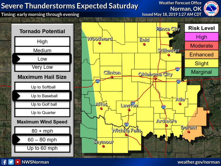
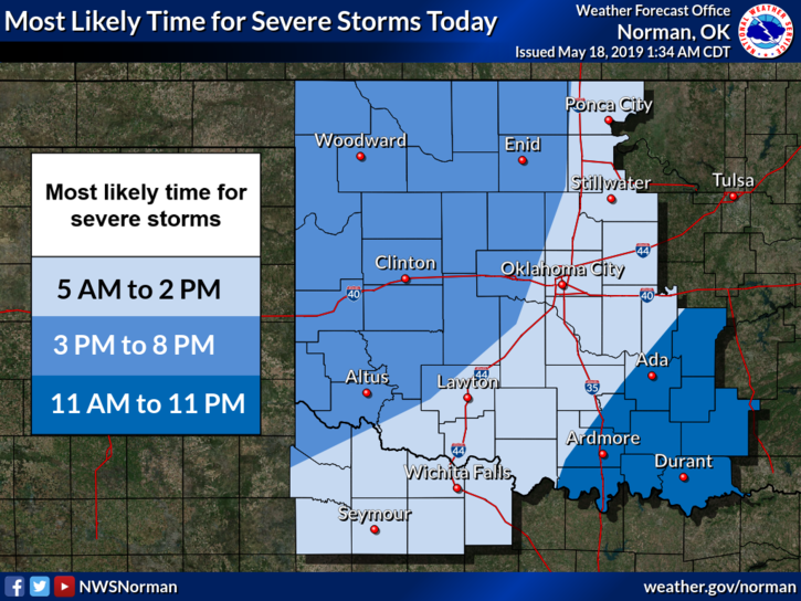
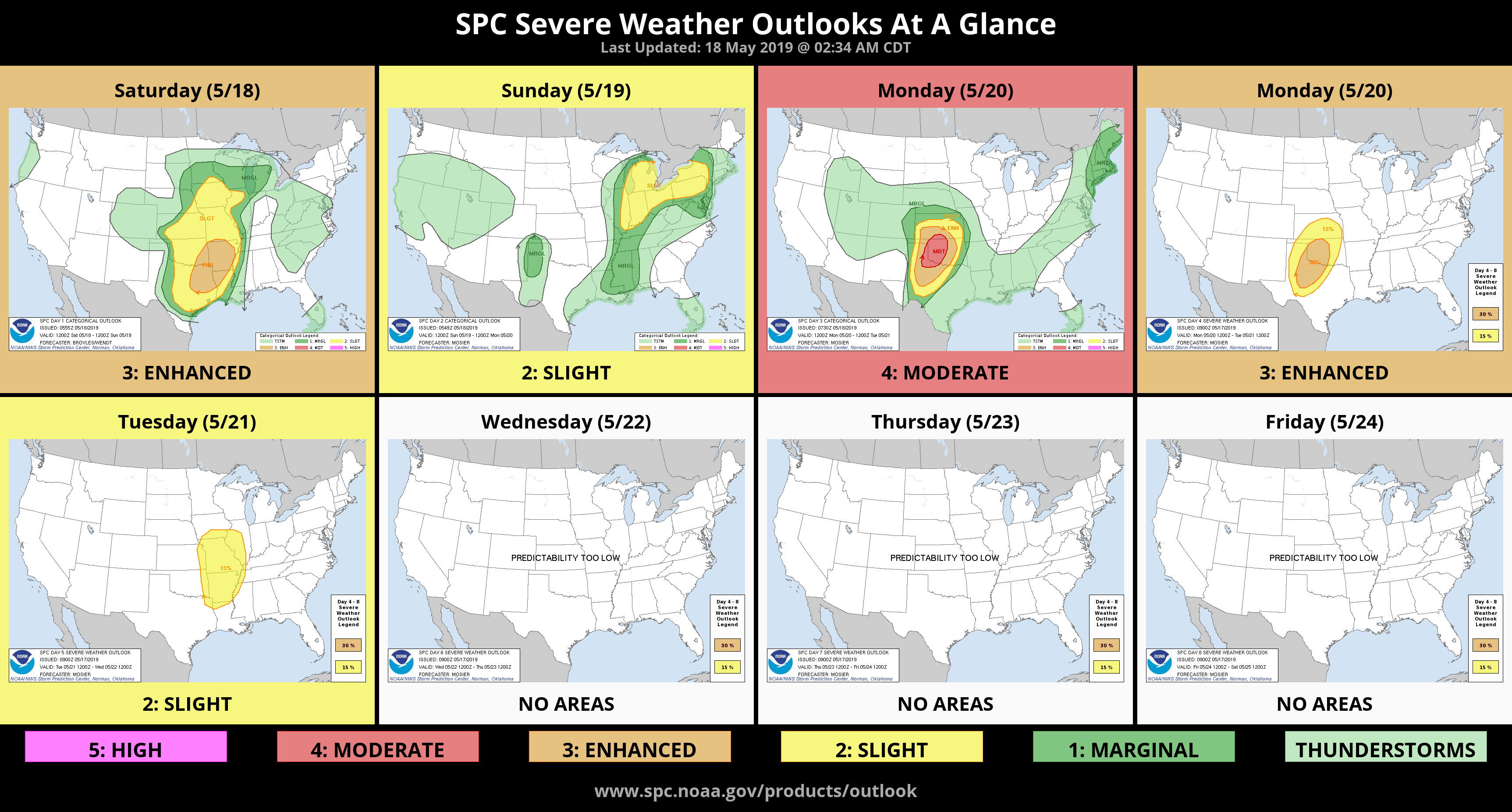
1- SLIGHT RISK for severe weather today. A cold front is moving slowly towards the area and storms may affect us later this afternoon into tonight. Main threats will be wind and hail. The tornado risk is low. Once the front pushes through, things will settle down for Sunday.
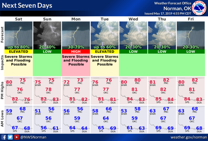
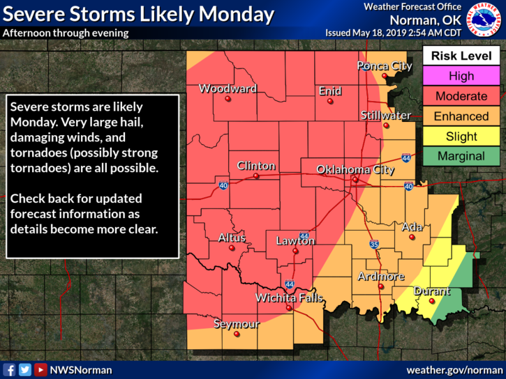
2- Read graphics attached to this post carefully and understand they WILL CHANGE as the day progresses. Monday’s graphic has changed a lot as we will be in a MODERATE RISK. We’ll see what happens.
3- We do expect thunderstorms today so as stated in past posts, don’t change any plans yet, BUT STAY WEATHER AWARE. I have another briefing today and will advise afterwards the latest thinking. PANIC is not necessary at this time.
4- Here is your forecast from the NWS/NORMAN;
Today- Mostly cloudy with a 40% chance of thunderstorms. Some may be severe this afternoon. Locally heavy rainfall is also possible. Highs in the upper 70s with South winds 15 to 20 mph.
Tonight- 50% chance of showers and thunderstorms in the evening. Some thunderstorms may be severe. Locally heavy rainfall possible with lows in the mid-50s. South winds 10 to 15 mph shifting to the west after midnight.
HAVE A GREAT DAY and I’ll advise after the briefing.
MIKE