0350L-FRIDAY OUTLOOK FROM GARFIELD COUNTY EMERGENCY MANAGEMENT-5/17/19
Our app- GARFIELD COUNTY EM = Preparedness. It’s your choice.
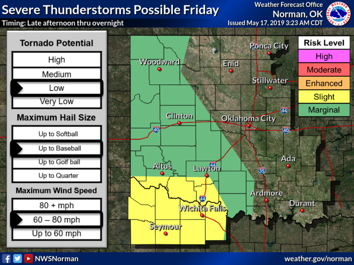
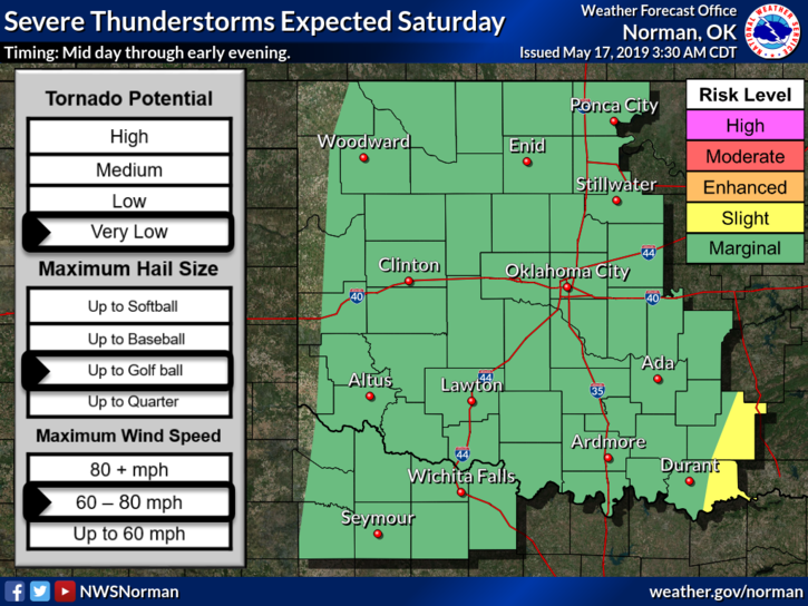
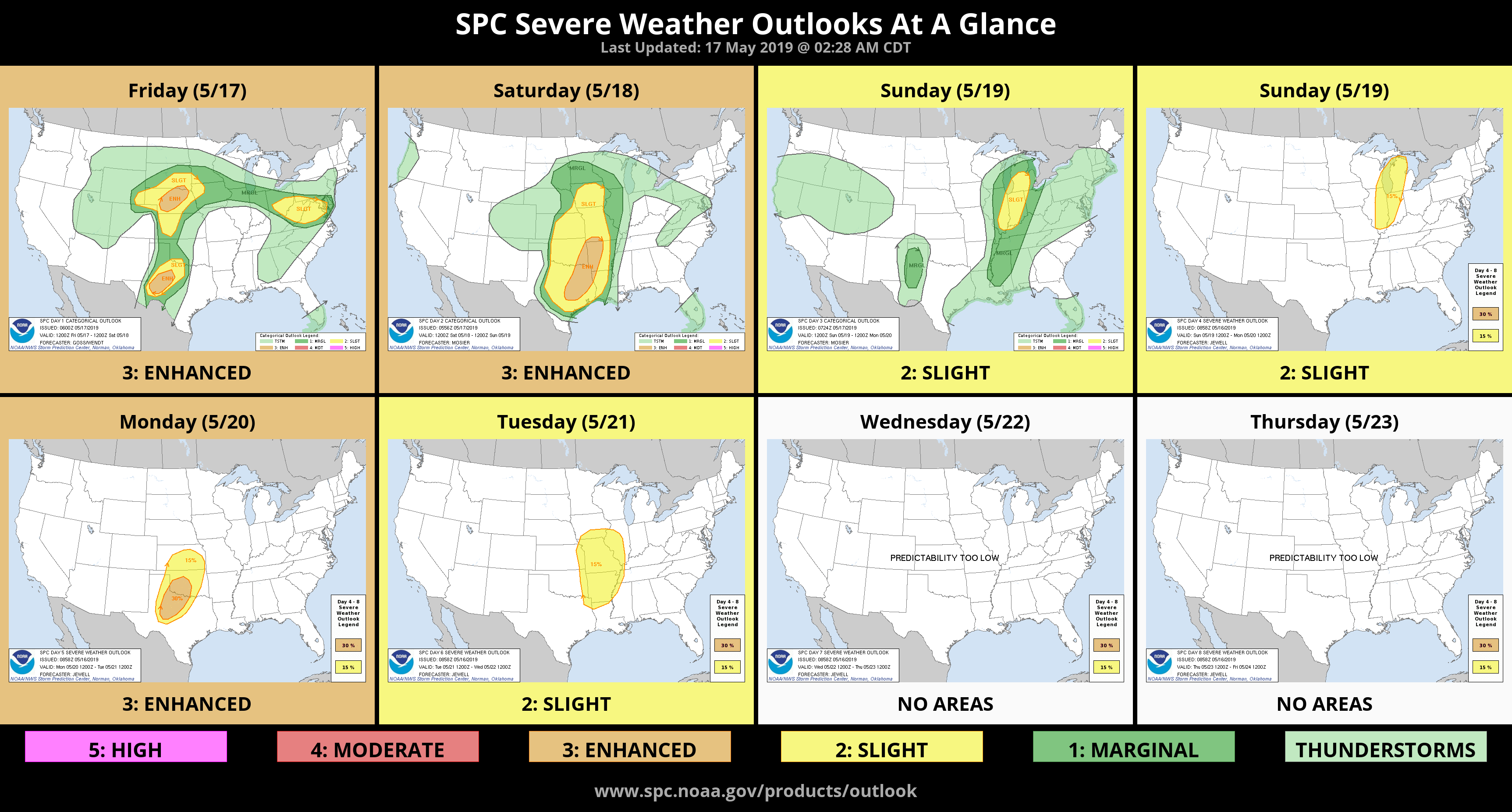
1- Several changes have occurred with where the worst storms might occur later today into tonight. The graphs have changed and they will change several more times. We do expect thunderstorms overnight with hail, wind, & heavy rainfall as the main threats so don’t let your guards down. DON’T CHANGE YOUR PLANS either but just stay weather aware.
2- We have another briefing today at 10 so we’ll see what they come up with. I will update everything after the briefing and re-post between 11am and 1pm.
3- Spotters are on stand-by so if they are needed, they’ll be deployed. Take a deep breath and let it out slowly. Do this several times. Relax and understand we’ll be ok. No need for high anxiety or panic. Remember –if you see this in my posts- bxaqgqqqgbqh hqhhqoqqoqhqq, I am in the panic mode. You don’t need to panic unless I panic.
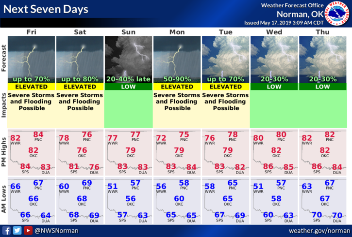
4-Here is your forecast from the NWS/NORMAN;
Friday-Increasing clouds, with a high near 83. South wind 15 to 25 mph, with gusts as high as 30 mph.
Friday Night-20 percent chance of showers and thunderstorms after 1am. Some of the storms could be severe. Mostly cloudy, with a low around 66. South wind 15 to 25 mph, with gusts as high as 30 mph.
HAVE A GREAT DAY!!
MIKE