0310L-SATURDAY OUTLOOK FROM GARFIELD COUNTY EMERGENCY MANAGEMENT-11/11/23
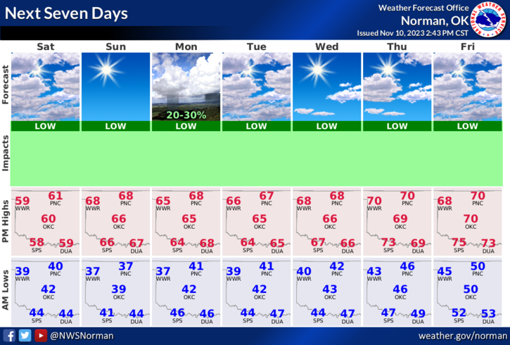
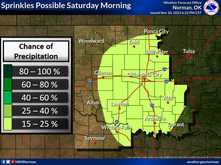
*PER GUIDANCE FROM THE NWS- A few sprinkles continue to fall mainly across northern OK early this morning as a shortwave trough and just enough moisture, lifts northeastward toward the OK/KS border. Other weak returns are noted over northern TX within a zone of low level isentropic ascent. This light precipitation should end near or just after daybreak, and cloud cover will slowly diminish behind the feature aloft by this afternoon. Highs this afternoon will be slightly cooler than yesterday given expansive cloud cover through most of the day and a surface ridge impinging a bit more from the ENE. Low temps will drop into the 30`s and 40`s tonight into early Sunday under clear skies and light winds.
Overall, we’ll be ok so here is your forecast from the NWS/NORMAN;
Today- Mostly cloudy. Occasional sprinkles this morning. Highs in the lower 60s. South winds 10 to 15 mph.
Tonight- Mostly clear. Lows in the upper 30s. South winds 5 to 10 mph.
*Be sure and download our GARFIELD COUNTY EM app and you’ll find our daily info under the GCEM BLOG icon, our gcem.org website on the front page or on Enid’s CITY CONNECT app.
HAVE A GOOD DAY!