0350L-SATURDAY OUTLOOK FROM ENID/GARFIELD COUNTY EMERGENCY MANAGEMENT-11/17/18
A COLD FRONT IS COMING. NO NEED FOR PANIC. WIND CHILL WILL BE A FACTOR.
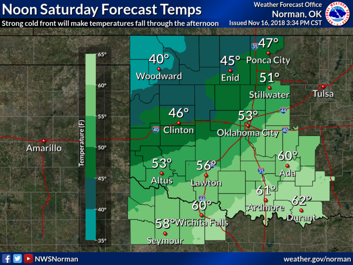
1- It’s going to get colder as the day wears on so make sure you keep a coat with you. The winds will make it seem colder and the wind chill will become an issue. There is a chance for precip later in the day.
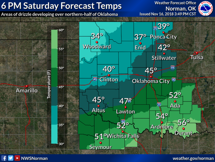
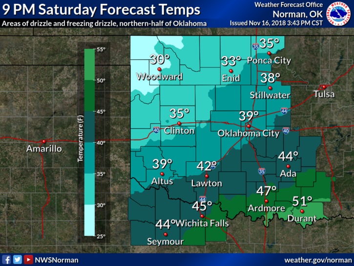
2- That chance is for some “freezing drizzle” later tonight as temps fall to and below freezing, so please plan accordingly since temps will fall as the day progresses. Falling below freezing shouldn’t occur until later this evening. Bridges and overpasses will become slick if this occurs.
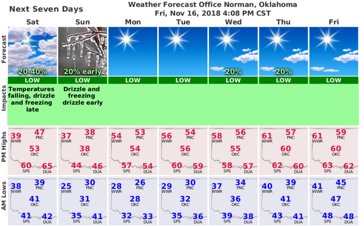
3- Overall, we’ll be ok. Here is your forecast from the NWS/NORMAN;
Saturday-Increasing clouds, with a high near 44. Light and variable wind becoming north northeast 10 to 20 mph in the morning. Winds could gust as high as 25 mph.
Saturday Night-Patchy drizzle or freezing drizzle before midnight, then patchy freezing drizzle. Cloudy, with a low around 29. North northeast wind 10 to 20 mph, with gusts as high as 24 mph.
Stay safe, dry and drive carefully.
MIKE