0330L-SATURDAY OUTLOOK FROM GARFIELD COUNTY EMERGENCY MANAGEMENT-11/28/20
GARFIELD COUNTY EM is our app. Preparedness=Resilience
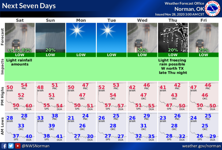
1- Winds will become southerly this morning and the clouds will move back in as we see a return of moisture occurring ahead of the next storm system. It appears the higher impact will be south of us. If we do see rainfall, it would be later this evening and overnight. The storm system will push through tonight from the west as a cold front pushes in from the north Sunday morning. No severe weather is expected. Overall, we’ll be ok.
2-Cooler temps will occur after yet another front pushes in leaving us on the cool side of guidance. Here is your forecast from the NWS/NORMAN;
Saturday- Increasing clouds, with a high near 51. Light and variable wind becoming south southwest around 6 mph in the afternoon.
Saturday Night- 40 percent chance of rain, mainly after midnight. Cloudy, with a low around 38. South southwest wind 5 to 10 mph becoming west after midnight.
HAVE A GOOD DAY!!
MIKE