FROM GARFIELD COUNTY EMERGENCY MANAGEMENT-SATURDAY-10/7/17
DOWNLOAD OUR EMERGENCY APP”GARFIELD COUNTY EM” IT JUST MIGHT SAVE YOUR LIFE!
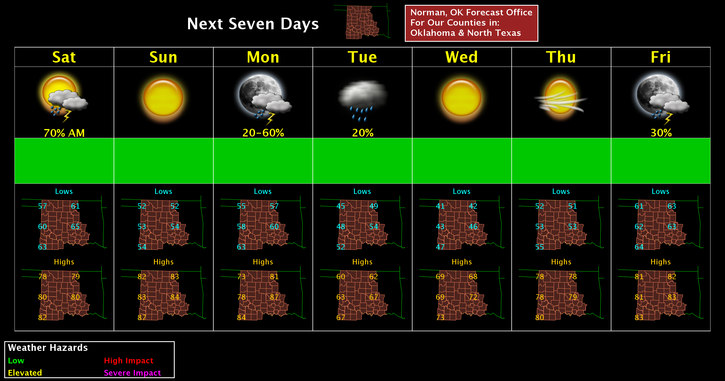
The storms system weakened as it made its way across the area but produced some rainfall, a really cool lightning show and some thunder. Overall, we’re ok. This upcoming week we will see high temps anywhere from the low 80’s down into the 60’s and well see overnight lows from the 50’s down to the low 40’s, give or take. We’ll also have an opportunity for more storms off and on too. See attached graph.
Here is your forecast from the NWS/NORMAN;
Saturday-Mostly cloudy through mid-morning, then gradual clearing, with a high near 77. Northwest wind 10 to 15 mph, with gusts as high as 21 mph.
Saturday Night-Clear, with a low around 52. South wind around 6 mph.
Have a great day!!
MIKE