FRIDAY WEATHER ADVISORY FROM GARFIELD COUNTY EMERGENCY MANAGEMENT-10/6/17
DOWNLOAD OUR EMERGENCY APP”GARFIELD COUNTY EM” IT JUST MIGHT SAVE YOUR LIFE!
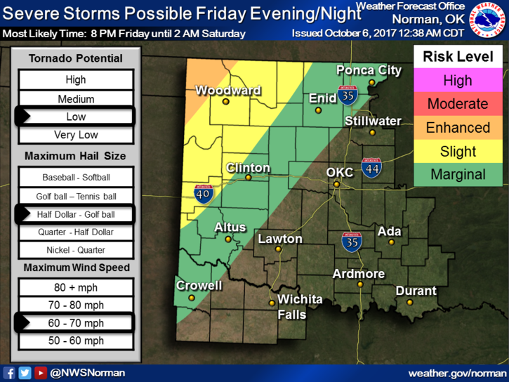
SEVERE WEATHER IS ON TAP FOR LATER TODAY AND TONIGHT. SEE GRAPH BELOW. Don’t get too fixated on where the lines are right now as they will change during the day.
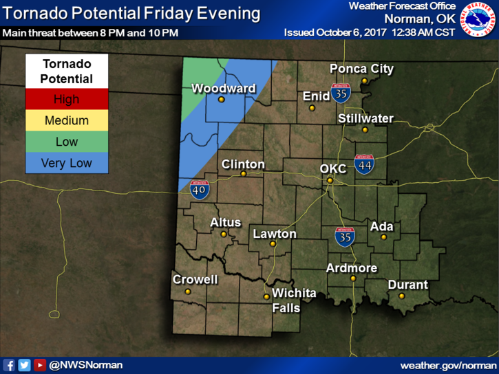
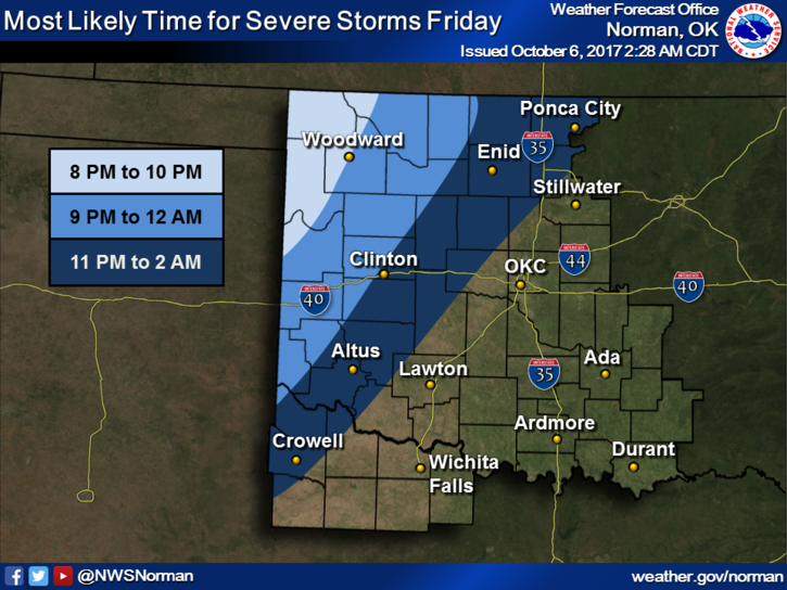
IF storms do occur expect torrential rainfall, strong winds, and large hail. By the time storms reach us, the tornado threat will be low but we stand a good chance for a WIND event. NO NEED TO PANIC as many things can happen between now and then. As it appears right now, this will be a 10pm or later event. Just stay weather aware and you’ll be ok.
Here is your forecast from the NWS/NORMAN;
Friday-partly sunny with a high near 86. South winds 10 to 20 mph gusting to 30.
Friday Night-90% chance for showers and thunderstorms, mainly after 10pm. Some of the storms could be severe. Low around 60. South winds 10 to 20 mph becoming northwest after midnight. Winds could gust to 25 mph.
HAVE A GREAT DAY AND I’LL ADVISE AS NEEDED.
MIKE