0405L-SATURDAY OUTLOOK AND INFO FROM GARFIELD COUNTY EMERGENCY MANAGEMENT-9/28/19
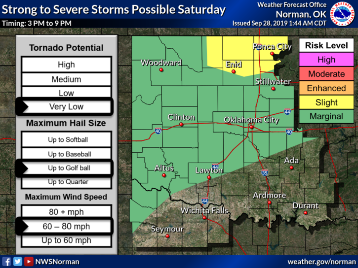
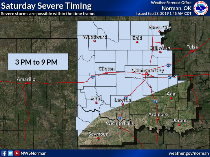
1- SLIGHT RISK for severe weather today and tonight. Winds-60-80 mph, Hail- up to golf ball in size and the tornado risk is very low. No need to panic but just stay weather aware later this afternoon. The front will push into the area this morning and stall thus putting us in a very likely area for heavy weather.
2- Besides the normal severe parameters, torrential rainfall and localized flooding are again possible with this mess so keep this in mind.
3- I’ll update later either this morning or afternoon if conditions change or you can keep up with the latest from the NWS/NORMAN- https://www.weather.gov/oun/ and make sure you have our GARFIELD COUNTY EM app.
4- Here is your forecast from the NWS/NORMAN;
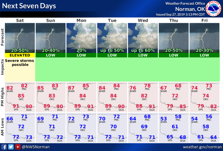
Today-Mostly cloudy. A slight chance of thunderstorms in the morning, then a chance of thunderstorms in the afternoon. Highs in the upper 80s. South winds around 10 mph. Chance of thunderstorms 50 percent.
Tonight-Mostly cloudy with a slight chance of thunderstorms. Lows around 70. South winds 10 to 15 mph. Chance of thunderstorms 20 percent.
HAVE A GOOD DAY!!
MIKE